The white pines of Hermit Lane

If you take a turn onto East Hermit Lane, just off of Henry Avenue after Henry Ave has crossed over going west from East Falls, and go down towards the site of the Kelpius cave, you’ll see on your left, on the east side of East Hermit Lane, a large stand of white pines.  Some of them are quite large, over two feet across, and with a canopy dozens of feet above the ground, they tower above the house that’s there.  Underneath them there is a ground layer with pokeweed, and jumpseed, and enchanter’s nightshade, and many other herbaceous plants, and there are also beeches and birches coming up in the understory.  But the white pines dominate, in terms of the aspect of the stand, and in terms of sheer numbers and size.

This stand is strikingly similar to one along Cresheim Creek, and based on their size, they (the ones along Hermit Lane, that is) were quite likely planted at a similar time as were the ones along Cresheim, and as is clear from the picture below, the Hermit Lane pines were there in 1931 which provides further evidence as to their age, and solidly provides an upper bound (of 1931) to their date of planting.

From the Library Company of Philadelphia Digital Collections: http://www.librarycompany.org/collections/prints/pr_research.htm

From the Library Company of Philadelphia Digital Collections: http://www.librarycompany.org/collections/prints/pr_research.htm
Aero Service Corporation, photographer; 1931  [The white pines are on the left side of the photograph, roughly midway between top and bottom of the picture, directly to the left of the Henry Avenue Bridge, which was being built at that time]

These trees along East Hermit Lane, however, while some of them are on a slope, most of them are not, and the plantings on the level grade are much denser in the above picture than the ones on the percent grade (this difference is also noticeable when you walk among them today), and so, different from the white pines of Cresheim Creek, the Hermit Lane pines probably weren’t planted for erosion control, but perhaps more broadly as part of reforestation efforts of a century ago, to bring back the sylva to Pennsylvania.

As was noted by John M. Fogg, Jr in his “Annotated checklist of plants of the Wissahickon Valley”, published in Bartonia (vol. 59) in 1996: “Although white pines may originally have occurred in the valley, the trees growing here today are the result of recent plantings.  A fine grove exists along Hermit Lane near Hermit Street.”

If we look at a map from 1895, we see that this locale (where the white pines are) was privately owned at that time, and though, as we see from a map of 1910, the neighboring lots were part of Fairmount Park by the earliest parts of the 20th century, this particular site (again, where the white pines are) was not.  If we assume that these trees were part of park plantings, and not plantings of private property, then this gives a lower bound of 1910 for the year of planting for these trees (given that the property was not part of the park in 1910, as indicated by the maps linked to above), thereby further supporting the argument that these trees date to the vicinity of about a hundred years, again, much like the white pines of Cresheim Creek.  And if we look again at that 1931 aerial, above, we see that the stand extends across the path that divides what was private property in 1910 from what was park property at that time. This further implies that the planting was associated with the park, and therefore would postdate the time when that lot became part of the park.

If we look at an aerial photo from 1937, then we see that the stand of white pines is visible, and quite prominent – densely packed in, and of a reasonably appropriate size for stand in its mid-twenties.  The second portion across the path is still there, visible in that 1937 photo, too.  And if we look at aerials from 1942 or 1957, we see that this stand of white pines is clearly apparent there, along with the portion to the southwest, across the path (it is no longer there today).  [to browse more aerial photos, see here: http://www.pennpilot.psu.edu/ ]

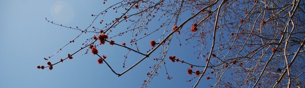
Something that we see as we look at these aerials across the 1930s to the 1940s to the 1950s, in addition to the stand itself, is also the wooded areas around it and nearby.  And from this we see that as the pines that were planted there grew, that there were wooded areas surrounding them, and they were growing too, until that landscape today yields an appearance of continuity – it is all “the woods”, even if some parts of them look a bit different from one another.  And if we walk there today, it can seem like the woods have always been there, in these large expanses, and that they are “natural”, in the sense of not having been made by people, that they just kind of got there on their own and that they keep on going and growing, all on their own.  After a century or so, it all just looks like woods, and the kind of woods that we might imagine has always been here. [NB: we heard Pine Warblers here on the 10th and the 13th of April, 2014 – and so one might say that the birds see the pines, too [note that Pine Warblers are not listed as being in Cresheim Creek, where there’s another thick white pine stand, in J. C. Tracy’s paper “the Breeding Birds of the Cresheim Valley in Philadelphia, 1942“, published in Cassinia]; I’ll note also that at this time (the 13th of April), along the Wissahickon, near and downstream from the Henry Ave bridge, that bloodroot and trout lily and spring beauty were all in flower and that Podophyllum was beginning to leaf out, too]

If we look a a photo from 1911, of the Lotus Inn, we see that there were a fair number of trees down in the ravine:

http://digitallibrary.hsp.org/index.php/Detail/Object/Show/idno/458

The above photo was taken a bit downstream from the Walnut Lane Bridge; it’s where the Blue Stone Bridge is now; that bridge was the continuation of the road you see there in that photo – it’s now the trail that leads up to the Henry Avenue golf course (it used to be Rittenhouse Lane).  That is, it’s just a bit away from where the white pine stand of Hermit Lane is now. [I’ll note also that it looks like there’s hemlocks there, too]

More broadly, looking around Philadelphia today, along the Wissahickon or the Pennypack, or in the wooded areas of West Fairmount Park or Juniata Park, or throughout so many of the many other parkland areas currently in Philadelphia, we see forests, and it can seem some times as though that it how it has always been.

Certainly, when William Penn arrived here in the 17th century there were woods woods woods and more woods, filled with all kinds of trees.  But by the 20th century, these had been cut over, multiple times (see page 39, here, for more about this), and also just prior to and at that time (the late 19th and into the 20th century, that is) was a period of incredibly extensive development across Philadelphia, and therefore wooded areas were being rapidly cleared to accommodate housing, and also businesses and industry – the economic drivers of a thriving city.   This period was an intense time for this – there was roughly a doubling of the population of Philadelphia between the 1850s and 1890 (according to US Census data), when we went from about a half a million to about a million people, and then the population roughly doubled again, until we hit about two million people in the mid-20th century, and one need not imagine the impact this would have on the woods, this massive population expansion.  We can also see this expansion of urbanization in the reduction of farms and farmland here – we go from 824 farms in Philadelphia in 1910, to 423 in 1920, to 381 in 1925 (data from the 1925 Census of Agriculture), which represented a reduction in farm acres in Philadelphia from 30,488 acres, to 17,408 acres, to 15,971 acres at each of those steps (Philadelphia’s total land acreage is about 82,000). By the 1950s, this had declined yet more, to 76 farms (5,024 acres) in 1954, and 53 (3,465 acres) in 1959; as of the latest census of ag, in 2007 there were 17 farms comprising a total of 262 acres.  (for more historical ag census data, see here: http://agcensus.mannlib.cornell.edu/AgCensus/homepage.do, and for current and more recent: http://www.agcensus.usda.gov/index.php; specifically for Pennsylvania: http://www.agcensus.usda.gov/Publications/2007/Full_Report/Volume_1,_Chapter_2_County_Level/Pennsylvania/; additionally, in 1911 there were 1,474 license issued to “farmers”, according to the Annual Report of the Bureau for City Property for the year 1911).  Transportation affected this as well – farms could move out  of cities because of improved transportation (e.g, train lines), which could move food quickly across long distances (and with the advent of the refrigerated rail car in the 1890s, this adds in to the calculation as well).  Also, in the 20th century, with the shift from horses to cars for transportation, the decrease in the horse population numbers would have meant a reduced need for hayfields, and so as fewer horses were fed, farmland (for hay, in this case) would have had less of an economic simulus to stay open. (for an article on horses and cities, see: American Heritage Magazine, October 1971)

At the height of our deforestation rate, in the mid-19th century, a wooded site in our region would be cut about every 25 years (for a 4% (that is, 1/25, or one out of every twenty-five years) deforestation rate).  These woods that were being trimmed on the scale of decades were or had been cut to clear land for development, and for farmland, and to build houses (and for other lumber needs, like furniture or cabinets and what-have-you), and also for firewood, wood being the dominant energy source in the US pretty much through to the end of the 19th century, as can be seen in figure one, here; stoves also had an impact, as can be read about in “Forest Conservation and Stove Inventors: 1789-1850” [by William Hoglund, 1962]), and so it’s not like there would have been a single episode of cutting at a site as land was cleared and houses were built from those trees that were cut, and then everything then would have commenced back to growing into woods again, but deforestation was a continuous local process at that time, due to energy needs, as well. (e.g., as the use of coal increased, the cutting of wood for fuel would have decreased, thereby increasing forestation) [They were also cut for other reasons, even amidst revolution, as John Thomson Faris relates in his 1932 Old gardens in and about Philadelphia and those who made them: ‘…in 1782, the Corporation of Philadelphia ordered that all trees in the streets of the city be cut down, because “they obstructed the prospect and passage through the public streets, lanes, and alleys,…disturbed the water-courses and foot-ways by the extending and increasing of the roots.”  Then it was felt that they were apt to “extend fire and obstruct the operation of the fire engineers.”  Then, with rare humor, the additional indictment was given: “They were not affected to the government because they remained with the enemy when they had possession of the city!” ‘ …. Faris goes on to write that “Fortunately the strange law was repealed in season to save some of the trees that were the glory of the streets of the city.”]

By the late 19th century, the deforestation rate had slowed a bit, to about 2%, but that still means we’d expect stands to be at most about 50 years old at that time, in the late 19th and early 20th century, which is the time when we see the oldest portions of the lands that are now forested in Fairmount Park becoming the natural areas that we now know them as.

That is to say that Fairmount Park was still quite young, by arboreal standards, as the 20th century arrived and moved forward – the oldest parts of it were on the order of a half century old at that time (dating to roughly the mid-19th century, that is), and many large parts were still coming to the city as the 20th century rolled on (for example, like the Pennypack, whose land starts being acquired by the city in 1905, and of course the site upon which the Hermit Lane pines now stand comes to the city around this time), and so the woods of Fairmount Park that we see now, filled with enormous tulip poplars and oaks and pines, and hemlocks, too, would have been pretty young at that time, and nowhere near as full as what we see today. 

I’m not aware of any stands in Philadelphia that are older than 100 to 150 years old, and this is pretty well in line with the historical data outlined above.  This is not to say that there aren’t individual trees that are older than that, as we know that there certainly are ones much older than this (e.g, in Hunting Park), or even some groupings of older trees (e.g, if you go along the rocky hilltop trail along the Wissahickon, just north from the Henry Ave. Bridge, there’s some wonderfully old chestnut oaks growing among the rocks overlooking the Wissahickon there that, based on their size, quite clearly predate the late 19th century), but I’m not aware of any substantial stands of trees in Philadelphia that predate the late 19th century.

And so we see in the first half of the 20th century a low of the areal extent of the forestation of Philadelphia – the woods had been cut over multiple times by then, and older stands that might have been found in less populated areas, perhaps distant out in the far northeast, or way out in the wilds of west Philadelphia, both dry and wet, were being cut down for the development that accommodated our growing population, and the current grandeur of Fairmount Park was still a young sylva at the time, not yet grown to the size that we see now.

In the 1930s especially, it appears, Philadelphia had few forested areas – development had extended to parts of city that still had wooded spots, and Fairmount Park had not yet become the well forested agglomeration of sites that we know today.  Though it can seem difficult today to believe that our green city was once so unwooded, an illustrative anecdote of this is provided in Richard Miller’s paper, “the Breeding Birds of Philadelphia”, in volume 51, number 7 of the Oologist (“for the student of birds, their nests, and eggs”), published in 1933, where he notes of the American Crow that it is “Common, but slowly decreasing, due chiefly to destruction of woods.”  (I also note that the Red-Bellied Woodpecker, a bird of forests and woodlands, is not listed in Miller’s paper – this is a bird that I commonly see now, along the Wissahickon, and elsewhere (e.g, at Bartram’s Garden, on the 5th of April 2013), which calls to the increase of trees in Philadelphia, I note; this is a bird whose range has expanded northward generally in the past decades, I also note; NB: notes are good).

Nowadays, so far as I am aware, no one fears for the crows due to lack of woods, and in this we can see the change from then to now – today there are wooded areas throughout the city, from Cobbs to the Poquessing, and so many places in between, where there are not just trees, but forests, and woodlands.  Our landscape has changed drastically from a century ago – the woods we see now have grown since then, and what were once open areas are now wooded.  Of course, the opposite has also occurred – what were once wooded areas now are not, and are now populated by buildings or streets or mown parks (sometimes this happened with quite a bit of opposition, as the fight over “Sherwood Forest” prior to it being cleared illustrates), and so it’s not like the woods have all grown up everywhere throughout Philadelphia, but as those wooded areas were being cleared, elsewhere parklands grew, and weren’t then cut again to clear the land, or for timber and fuel, and so we see this striking change throughout the landscape, from a hundred years ago to today.

All of this change might make one wonder about ticks, for example Ixodes scapularis, the black legged tick; this species was named and described by Thomas Say, and that was done in the Journal of the Academy of Natural Sciences of Philadelphia (Vol. 2, 1821: pp. 59-83 – thanks to Ken Frank for pointing this out to me, by the way).  Say mentions of this species: “Rather common in forests, and frequently found attached to different animals.”

There also were differences in wetlands, between now and a hundred years ago, as is indicated by the inclusion of Typha angustifolia and “Phragmites Phragmites” (i.e., Phragmites communis), in Thomas C. Porter’s “Rare Plants of Southeastern Pennsylvania”, which is in the Botany Libraries at Harvard (it has a publication date of “March, 1900”).  These wetland plants are quite common in Philadelphia now.  An indicator of changes in wetland quality in the Wissahickon is that Chrysosplenium americanum, an indicator of pretty nice wetlands, was collected in the Wissahickon in the 19th century (by J. B Brinton on the 10th of June 1888 [with “fruit”, as indicated on the herbarium sheet], and by Albrecht Jahn on the 5th of May 1895 – both of these collections are at PH), but hasn’t been seen there recently.

And there are plants that we likely have fewer of now, most likely due to increased forestation (succession, that is) and development – like Hypericum gentianoides, which does occur in Philadelphia today (it was flowering in Haddington Woods, out by Cobbs, on the 2nd of September 2015), but we don’t see it often.  Barton (1818), however, notes it as: “In exposed situations on sterile soil; generally on roadsides; not uncommon.”, and it is included in Keller and Brown (1905), and Rhoads and Block note it as being “common” (though this is not a particular note about Philadelphia).  Also, in the Plants of PA database, there are multiple entries, indicating that it was collected multiple times in Philadelphia (from: Byberry, Cedarbrook, Germantown, Holmesburg, Mount Airy, Olney, Shawmont, Wissahickon Creek, Cedarbrook, Germantown), and in the herbarium of the Academy of Natural Sciences, there are multiple collections, one of which has on the label:

“Remains of last year’s plants forming almost pure stands in open
Coastal Plain sand-gravel; growing out of a covering of Cladonia.
This area was formerly covered by timber but is doomed to destruction
by real estate development.  S. W. corner of Cheltenham Avenue and
Easton Road.
Cedarbrook.
J. W. Adams  48-33
April 6, 1949”

There are 6 more collections at the Academy, whose labels read: 1) “1 Aug 1849  Germantown” by “R. C. Alexander”; 2) “Dry Sandy Soil / Olney, Phila Co. / July 30, 1922 / Collected by R. R. D.” [= R. R. Dreisbach] coll# 1-155; 3) “above Shawmont, e. side / Schuylkill. Phila Co Pa / Collected by S. S. Van Pelt / Aug 5 1902”; And another: 4) Wissahickon, coll: S. S. Van Pelt – Aug 15 1902; 5) “Openings between coarse grass tufts on sandy slope 3/4 mile south-southeast of Byberry / Edgar T. Wherry / September 19, 1954”; 6) “Weedy roadsides and old fields / 1 mi. n.e. of Mt. Airy / Florence Kirk / August 3, 1949”

And so we see that this plant of open places was historically pretty common, though it does not appear to be quite as common as it once was, here in Philadelphia.

There is, I should say, also continuity through time here – hemlocks have been here and are here now.  And many other plants, animals and fungi have been documented to have been here in the past and remain here to this day.  These include plants that are parasitic upon other plants – these persist as well, such as Conopholis americana, or Squaw-root, noted by Keller and Brown (1905) with a locality of “Wissahickon”, and that Barton (1818) noted as “Parasitic. On the authority of Mr. Bartram, I have introduced this plant, never having met with it myself. He says it grows in the woods near Philadelphia. Perennial. July.”  (however, in Norman Taylor’s 1915 Flora of the Vicinity of New York, which includes Philadelphia, he lists Conopholis americana for PA as “Bucks, Delaware, and Chester Counties” (that is, not Philadelphia); he also calls it “A rare and local plant” and its habitat as “In rich woods, usually at the bases of oak trees… Rare”; in Rhoads and Block (2007), the Plants of Pennsylvania, they note of squawroot: “parasitic on Quercus spp.; occasional in forests, mostly S and W”). [one wonders if this plant’s populations have grown more abundant in the past hundred years due to expansion of oak populations which grew due to decrease in population of their main competitor, the American chestnut, which decreased due to the introduction of the fungus Cryphonectria parasitica, the causative agent of the chestnut blight, doesn’t one?]

And there are plants that we still have, but in very different places, as we can read from Bayard Long’s 1922 paper in Rhodora (vol. 24), “Muscari comosum a new introduction found in Philadelphia” [the common name for this plant is grape hyacinth]:

“The collector of the specimen of Muscari comosum, Miss Adelaide Allen, fortunately was able to designate exactly where it had been obtained, as the spot lay along the familiar route from her home to school. Through her kindness, and the interest of Dr. Keller, we learned that it grew along the sides of a dyke, running in to South Broad Street from outlying farm houses, near League Island Park, in the southern portion of Philadelphia. This area consists in large measure of the extensive alluvial flats and marshes of the lower Delaware, more or less intersected by ditches. The region is not yet built up to any extent and the more elevated portions are frequently occupied by truck-farms. The southern extension of Broad Street, with its trolleys, offers one of the chief lines of travel in this particular locality, and the nearby farms often obtain access thereto by dykes laid down over the low meadows and more impassable places. These dykes are continually augmented by the dumping of ashes and rubbish down their sides. [note that the Dr. Keller mentioned above is the same Keller of ‘Keller and Brown’, mentioned previously]

In such a habitat from a detailed sketch map furnished by Miss Allen the Muscari was found growing.”

This plant persists from then, as is noted by John M. Fogg, Jr in his “Annotated checklist of plants of the Wissahickon Valley”, published in Bartonia (vol. 59) in 1996: “Muscari botryoides. Grape-hyacinth.  Introduced and naturalized from Europe.  Occasional in woods and clearings.  Thomas Mill Road.” (and it still persists to this day – on 14th of April 2014, it was flowering quite well along the Wissahickon, for example in the floodplain just downstream from the Walnut Lane Bridge; it was flowering here the week of the 13th of April 2015) [note also that League Island Park was relatively recent, in the 1920s, having been acquired by the city in the 1890s by purchase/taking of a variety of tracts (total initial cost: $399,670), as provided by an ‘Ordinance of March 11, 1895, “appropriating League Island Park as an open public place for the health and enjoyment of the people.” ‘ (Appendix to the Journal of the Common Council, 1897-1898)]

And there are animals that also span the temporal divide – consider the Virginia opossum which, as is noted in Whitaker and Hamilton’s Mammals of the Eastern United States (3d edition; 1998), can live many places: “The opposum’s adaptability to a great variety of habitats, ranging from forest to purely agricultural lands, explains its success in the eastern United States.  It is often quite common even in urban or suburban areas, and many are found dead on the highways.” and “The opossum is a solitary wanderer, remaining in no one place for long, and may be found far from trees.  Its daytime den is in a fallen log, a hollow tree, a cleft in a cliff, a brushpile, a tree nest of a bird or squirrel, a woodchuck or sun burrow, or a recess under a building, or in many of other protected situations.  Opossums do not dig their own dens, and thus are dependent on other animals, primarily the woodchuck and skunk, for ground burrows.” – they mostly den in wooded areas, arboreally as well as on the ground (and “in snags and leaf nests probably used or constructed in years past by squirrels”), though they have also been reported to den in an old field.

This marsupial adaptability is reflected in the current presence of numerous opossums (opossa?) in Philadelphia today and their presence a century ago, as we see evidenced in the number of individuals presented to the Philadelphia Zoo for accession to its menagerie, in the early part of the 20th century, that came from Philadelphians – for example, from the “List of Additions to the Menagerie during the Year Ending February 28th, 1914”: “1 opossum presented by G.W. Cassel, Philadelphia.” (13 November) and “1 opossum ([male]) presented by Mrs. George Biddle, Philadelphia.” (9 December) and “1 common opossum ([male]) presented by Harry Rathbone, Philadelphia.” (13 January) and “1 common opossum ([male]) presented by Miss Theresa Hayes, Philadelphia.” (22 February); or for the year ending February 28th, 1914: “1 common opossum ([female]) presented by Walter Ellis, Philadelphia.” (13 March) and “1 common opossum ([female]) presented by Mrs. Harrold E. Gillingham, Philadelphia.” and “1 common opossum ([male])  … presented by Frank G. Speck Philadelphia.” (22 November) and “1 opossum ([female]) presented by Mrs. A. H. Gerhard, Philadelphia.” (1 December) and “1 opossum ([male]) presented by William F. Girhold, Jr., Philadelphia.”; and for year ending February 29th, 1912: “1 opossum presented by Master Ralph Fritts, Philadelphia.” (13 May) and “1 opossum presented by Guy King, Philadelphia.” (28 December) and “1 opossum presented by Mrs E. A. Cassavant, Philadelphia.” (4 February) and “1 opossum presented by The Walter Sanitarium, Walter’s Park, Philadelphia.” 18 February) and for year ending February 29th, 1920: “1 common opossum presented by Thomas Oakes, Overbrook, Pa.” (12 April)  and “1 common opossum a presented by Dr. Frank Fisher, Philadelphia.” (3 October) and “1 common opossum ([female]) presented by John A. Caraher, Philadelphi” [sic] (30 November) and “1 common opossum (male) presented by John J. Daly, Philadelphia.” (23 February).  All these and more can be read in the Annual Report of the Board of Directors of the Zoological Society of Philadelphia volumes 40-49; be sure to note also how many people from Philadelphia were donating alligators in those years.  Note also the numerous birds and other animals that were either “caught in the garden” or “found in the garden” (including at least two screech owls).

While the above mentioned animals were caught and presented live to the zoo, I do want to note that opossum were hunted and eaten here historically, as well, as we can see from an 18th century letter from Father Joseph Mosley, to his sister (writing from St. Mary County, Maryland – 1st of September 1759; the following letter was published in the Records of the American Catholic Historical Society of Philadelphia, Volume 17; 1906)

“Our game is very plentiful, as in shooting possums, deers, wild turkeys, raccoons, squirrels, pheasants, woodcocks, snipes of different sort, teal, wild ducks, wild geese, partridges, &c., but all different from birds of the same name in England, and all very good eating except the raccoons. Panthers have been seen in this country, but not of late years. We have turtles, or tortoises, of all sorts We abound with all sorts of fruits, so as even to feed the hogs with peaches that would sell very dear at your market.”

You’ll notice that deer are on that list, and second only to possums – these animals are quite common now in Philadelphia, but this was not always the case, as is evidenced by the purchase of a male white tailed deer by the Philadelphia Zoo, on the 4th of April 1911, as is noted in the Annual Report of the Board of Directors of the Zoological Society of Philadelphia volumes 40-49; “List of Additions to the Menagerie during the Year Ending February 29th, 1912” … “1 white tailed deer ([male]) purchased.”)

I’ll note here that peaches, mentioned in Father Mosley’s letter, though an introduction from the old world, have been here for quite some time – Peter Kalm mentions them multiple times in his Travels into North America; they are mentioned by Peter Collinson in letters he wrote to John Bartram; and William Penn mentions them in one of his letters home: “Here are also peaches, and very good, and in great quantities, not an Indian plantation without them; but whether naturally here at first I know not.“ (extract from “A Letter from William Penn, Proprietary and Governor of Pennsylvania in America, to the Committee of the Free Society of Traders of that Province, residing in London,”).

But back to the opossum –  while this animal was present here, it was not quite as common towards the mid-part of the 20th century as it is now, as is noted in Philadelphia: a guide to the nation’s birthplace (1937; Pennsylvania Historic Commission and Federal Writer’s Project):

“With so much of the wildwood atmosphere still preserved, Philadelphia has its share of bats, squirrels, chipmunks, rabbits, weasels, and the smaller rodents, such as the meadow mouse and the white footed deer mouse.  The raccoon and opossum are now rarely found, but are still encountered in the deeper rural sections of this district.”

And so, in the overall change of Philadelphia’s ecosystem over the centuries, many of the moving parts have remained, though they may have shifted gears a bit.

This succession, the change in urban ecosystems through time, is not, as is illustrated by the Hermit Lane pines, strictly a passive process.  It is, or at least can be, actively facilitated by people and their (or “our”, I should say, since we are all people) management – by planting those white pines, for erosion control or for reforestation, this altered the pattern of succession that we would have seen otherwise, from what we most likely would have seen, or at least what I’d expect to see, which would be a stand of tulip poplars, that would’ve now had trunks about a meter across and would now be just about reaching the end of their lifespan, to this massive stand of white pines that we see today.  This occurred not by chance, but by human intervention, and is the reason that what we see today is there as it is.

By looking at these old photos and maps, by reading old reports and census documents, by understanding landscape ecology and succession, we can see how what was done before has brought about what is here today – we can see the enormous changes that have affected our city, and often be quite surprised at just what those changes were and how they came about.

It can be surprising to realize that Philadelphia has more dense forest today than it did a hundred years ago, and also then to learn the other impacts this brings about, on birds, as mentioned above, and also on water quality, among other environmental factors. And it is key to realize that this did not happen by chance; ecology in cities is due directly to actions by people, and always has been, for a very long time, as we see from those pines that were planted a century ago.  We are part of these ecosystems, and thoughtful decisionmaking, such as that in the Philadelphia Parks and Recreation’s recently released Parkland Forest Management Framework, is needed for making these decisions in a way that will be amenable to all of us in and for Philadelphia, both now and in the years, decades, and centuries to come.

Hunting Park

Hunting Park, which is worth a visit, is a wide open area of green comprising about 87 acres in North Philadelphia, and while it has certainly changed through the years, it has always been filled with plants.   Originally part of the James Logan estate (that included nearby Stenton), this particular parcel was sold in the early part of the 19th century and soon thereafter there was a racetrack here that was active and running up until the mid-1850s, when the land came to the city to be used as a park, and by 1937 Hunting Park had a “music pavilion, tennis courts, a lake, and a carrousel“.  

In 1872, the park came under the Fairmount Park Commission, and it stayed there until 2009, when the combination of the Fairmount Park System with the Department of Recreation made what is now Philadelphia Parks and Recreation, a department in the city that manages thousands of acres of natural lands, playgrounds, and much, much more, including Hunting Park.

The lake there (mentioned above) was a wading lake, a lot of it less than knee deep, depending on the depth of your knees, and pretty much all of it below the waist, given that it was a “wading” lake, and it was huge – as can be seen in the aerial photo here, the lake stretched about a block and half’s length north to south, and about the same, roughly, from east to west, forming somewhat of a boomerang shape, pointing towards the west, with a smaller pool, perhaps for smaller children, at the northern tip of it.  You can further get a sense of its size by the aerial photo here, from 1939.  Also note from the 1843 map here that the site where Hunting Park is now didn’t have much in the way of streams or creeks running through it, which says that the lake most likely wasn’t a dammed waterway, but was more likely simply a large expanse dug down until groundwater was hit and that then filled the pond.  The pavilion at the crook of the boomerang’s elbow, on its east side, is still there, but the lake is not.

There is a magnificent tupelo (Nyssa sylvatica) just to the west of where the lake once was, and across the way from where that pavilion still stands:

Hunting Park tupelo; photograph by Ned Barnard, 25th of August 2013

Hunting Park tupelo, with historic pavilion visible at the far side of the soccer field; photograph by Ned Barnard, 25th of August 2013

Given its size, this tree was mostly likely there when the lake was – shading bathers from the summer sun, and providing brilliant red foliage in the autumn to give a vivid signal of the end of the swimming season.

Now there are playing fields there, where the lake once was, and a swimming pool, too, at the lake’s historic center, and on a warm summer day those fields will be filled with people, playing soccer, playing baseball, and watching others do the same, and just enjoying being out of doors.  At the southern part of this area, next to the baseball field, is an old cedrela, or toon tree.  It’s roughly the same size as ones growing along West Vernon Rd in Germantown, along the former border of where Meehan’s Nursery used to be, and the one in Hunting Park may well have come from Meehan’s, as they were a major tree supplier in Philadelphia, and also they sold Cedrela trees from 1896 onwards and through to the 1910s, as a look at their catalogs (many of which are in the PHS McLean library) shows; and they were pretty excited about this tree in 1905, writing that it is “Such a good plant that we intend to make a great feature of it as soon as we can grow a stock large enough to meet the demand its merit will create.”

In the 19th century, William Saunders, partner of Thomas Meehan (proprietor of the eponymous nursery, mentioned above), laid out a design for Hunting Park, and there are trees there still that look, from their size, to be from that time, and therefore perhaps from his design.  There’s a huge sugar maple, for example, just to the east of the community garden, in the western part of the park, and oaks, including scarlet, red, and white, in the southern section of the park, all of which look to date from the late 19th century based on their heights and widths.

And there is even a tree that pretty clearly pre-dates the park itself – a willow oak that’s pretty hard to miss, given the sign pointing right at it:

Hunting Park historic tree sign, photograph by Nick Tenaglia, 25th of August 2013

Hunting Park historic tree sign, photograph by Nick Tenaglia, 25th of August 2013

This sign, similar to the one pointing towards the Buist Sophora in Southwest Philadelphia, points to this Quercus phellos:

Hunting Park willow oak, just south of West Hunting Park Ave, just inside the park, Old York Road side (west side); photograph by Nick Tenaglia, 25th of August 2013

Hunting Park willow oak, just south of West Hunting Park Ave, just inside the park, Old York Road side (west side); photograph by Nick Tenaglia, 25th of August 2013

It’s enormous, as you can tell from the apparently tiny people who are at the base that are, I can tell you, all over 5 feet tall, and some a fair bit more than that.  Based on its size, we can pretty confidently say that it dates to the mid, if not early, 19th century, if not before, and it has accompanied the historic building (at the very southwest corner of the park) through the centuries, and through to today.

That tree came down  the storm on the 2nd of March, 2018: https://twitter.com/RKPHL/status/969957405940502529

Across Roosevelt Blvd from the park is the Logan Triangle, a site where houses once were.  This development was built in the 1920s, on top of what was once the Wingohocking Creek (or see here) but has now all been filled in and covered over.  However, it wasn’t filled in sturdily enough, not strongly enough to hold the houses built above it, and in the 1980s houses tragically exploded, and the city, along with the Logan Assistance Corporation and the federal government, worked towards relocating the nearly thousand households impacted by this and removing most of the buildings that were there, and about 16 blocks there are now open green space – some butterflies fly there (e.g, sulphurs, that we saw on the 25th of August 2013), and there are open fields that look like rural fields, and also a bit of short dumping where people have left their trash for others to clean up after them, and the area today forms a curious counter image of green space to the park, Hunting Park, on the south side of the Boulevard.  (These kinds of problems have also occurred elsewhere in Philadelphia: in Wissinoming, Mill Creek (in West Philadelphia), and Roxborough and Wynnefield)

From J. Thomas Scharf and Thompson Westcott’s History of Philadelphia, 1609-1884:

“The Wingohocking (Winge-hacking) is thought to mean “a good place for planting.”  This stream is also called “Logan’s Run,” because it flows by Stenton, the country seat of of James Logan, Penn’s secretary; it rises near Mount Airy, and the Tacony in Montgomery County.”

As a side note – upstream from here, as the Wingohocking flows (underground, today), is where Charles Willson Peale‘s house once was (it is now part of LaSalle‘s campus), and there was beryl, a gemstone, there, too: “This mineral is found on Mr. C. Peale’s farm near Germantown” (Isaac Lea, “An Account of the Minerals at present known to exist in the vicinity of Philadelphia”, Vol. 1, Journal of the Academy of Natural Sciences of Philadelphia, December of 1818) [and for more about some plants that grew along the headwaters of the Wingohocking in the 1920s, see within here: https://growinghistory.wordpress.com/2012/04/22/paulownia-tomentosa-the-empress-tree/]

If you walk over to Logan Triangle from Hunting Park, and you decide to go via Old York Road, perhaps to walk over the ground where the Excelsior Brick Works was (as can be seen in the 1895 map here), take a look just a little bit to the east, just south of the Boulevard, and you’ll see the apple tree that Joe Rucker discovered there recently, and if you’re there in late summer or early fall, you can eat the apples off of it, too  (just be careful of the poison ivy growing on and near it)

To read about some other parks in Philadelphia, see here:

Wissinoming

West Fairmount Park (Michaux Grove, specifically)

Cresheim Creek

The Wissahickon (its hemlocks, specifically)

And for further reading about Hunting Park…

http://www.philadelphiaweekly.com/news-and-opinion/cover-story/Hunting-Park-Bounces-Back-80763797.html

http://teachers.yale.edu/curriculum/viewer/initiative_15.03.03_u

William Hamilton, Lombardy poplars, and the landscape of cemeteries

From Erica Maust, of the Woodlands Historic Mansion, Cemetery, and Landscape:

“In 1784, William Hamilton introduced the Lombardy poplar to North America on his Philadelphia estate, The Woodlands. In 1788, a visitor to The Woodlands wrote that Hamilton’s walks were “planted on each side with the most beautiful & curious flowers & shrubs. They are in some parts enclosed with the Lombardy poplar except here & there openings are left to give you a view of some fine trees or beautiful prospect beyond…”

Grove Street Cemetery in New Haven, Connecticut was the first private, non-profit cemetery in the world. Organized in 1796 as “the New Burying Ground in New Haven,” it was one of the earliest cemeteries to have a planned layout with privately owned family lots, named streets and avenues, and arrangements of ornamental plantings. The original 1796 planting scheme of the cemetery featured regular rows of–you guessed it!–Lombardy poplars (the very same tree Hamilton introduced to North America 12 years earlier), along with a poplar grove and meadow at the rear of the cemetery.

44 years later, in 1840, Hamilton’s very own landscaped Woodlands became a planned, rural cemetery, preserving his landscape and horticultural pursuits.”

For more, see here:

https://www.facebook.com/woodlandsphila

And for more about William Hamilton and the Lombardy poplar:

http://arnoldia.arboretum.harvard.edu/pdf/articles/904.pdf

Ailanthus, House Sparrows, and Eastern Gray Squirrels

Matt Kasson (currently at Virginia Tech) has tracked the movement and growth patterns of Ailanthus altissima, the “tree of heaven” –

http://news.psu.edu/story/280078/2013/06/24/research/ailanthus-trees-status-invasive-species-offers-lesson-human

A brief historic note on the Ailanthus, from the “Conchologists’ Exchange“, where John Ford (Philadelphia, PA) writes of the genus of land snails, the genus Helix, in 1887:

“Unfortunately there are not many to be seen at the present time as the blasting for the new River Road destroyed most of the Ailanthus bushes upon which they chiefly fed. Only a short time before the rocks were removed I took over 200 specimens from a space less than 50 feet square. A number of these were captured upon the Ailanthus bushes in the act of eating the foul smelling leaves, a fact which seems to prove that no plant is too offensive to be used as food by some animal.  Very many of these specimens were in perfect condition; as may be learned from the sample in the Philadelphia collection on the second floor of the Academy of Natural Sciences. The writer was the probable discoverer of this colony, which it is safe to say has never been equalled in this region either in number or in perfection of form and color.

Nearly opposite to this locality on the west side of the Schuylkill just south of the bridge crossing the old carriage road very many H. libera and H. allemata may be found Here the conditions are much the same as were those already described; large stones being scattered about and many Ailanthus bushes growing between.”

Another organism that eats Ailanthus altissima is the Ailanthus silkmoth, as is detailed in Ken Frank’s History of the ailanthus silk moth (Lepidoptera: Saturniidae) in Philadelphia: a case study in urban ecology, from volume 97 of the Entomological News (1986), available for perusal here.

And the Ailanthus webworm can currently be found in Philadelphia:

https://ecologyofwestpark.files.wordpress.com/2015/07/000-moths-at-light-in-center-city-4.jpg

And as we read in the  Proceedings of the Academy of Natural Sciences of Philadelphia, Volume 34 (1882):

“Prof. Leidy further remarked that the past season had appeared to be favorable to many of the Lepidoptera. Our shade-trees had been greatly ravaged by the Orgyia; many of the poplars had suffered from the Clostera inclusa, and he had observed an unusual quantity of the Ailanthus silk worm, Attacus cynthia, upon the Ailanthus-trees. The latter was introduced here in 1861, by Dr. Thomas Stewardson”

Additionally, from Scharf and Westcott’s History of Philadelphia (1884):

“The State-House [= Independence Hall] pavement was a wide and unpleasant place in warm weather when the sun was shining. Fully exposed, and reflecting back the heat, it was, in consequence of the buildings being far back from the line of the street, less attractive than sidewalks across which neighboring houses threw a shade in some periods of the day. No attempt was made to introduce any improvement until the fall of 1821, when trees were planted in front of the State-House, extending from Fifth to Sixth Street. Poulson [=publisher of the Daily Advertiser] said in reference to this improvement, “It will be a salubrious exchange for the arid bricks that have been broiling our brains there for fifty years.” The trees chosen were ailanthus, noted for quick growth and thick foliage. In ten or fifteen years the front of the State-House in summer time was as umbrageous as a forest. Afterward these trees were attacked by worms, and were ordered to be cut down. The axe was applied at some little distance above their roots, and in a few hours the grove, once the glory of the city, the favorite place in which the town politicians assembled to talk about nominating and elections to discuss political affairs -where they were commonly called “tree toads” – presented the dismal appearance of a forest in which the wood-choppers had been entirely too busy. The public could not stand that. In a short time new trees (silver maples) replaced the ailanthus, the idea being from experience that they would not be disturbed by the worms. They grew finely, and in a few years the grove in front of the State-House was restored to its original beauty. But just about that time the worms gave proof that they would change their diet upon necessity rather than starve. The ailanthus and paper mulberry having been almost exterminated as a sidewalk tree in the streets of the city, the worms accommodated themselves to circumstances, and condescended to devour the leaves of the maples.

In time the English sparrow was imported, and he justified the expectations founded upon his change of country by attacking the worm vigorously. In the meanwhile many years had gone by, and a considerable number of the trees had yielded to natural decay. When about 1876 it was determined to replace the brick footways by a pavement of slate, there were very few of the old trees left. It was not difficult to dispose of them. By covering the surface with the stone and making no provision for watering the roots, the remaining trees gradually died off, so that in 1884 there is probably no survivor of this most beautiful grove which for many years was the most attractive place on Chestnut Street”

Note: Philadelphia was the site of what was most likely the largest introduction of house sparrows (Passer domesticus) into North America: one thousand of them, in 1869

Philadelphia also appears to be the first city in North America in which “free-living” squirrels were released for the edification and enjoyment of the populace, and they (the squirrels, that is) were even provisioned with food and little homes, beginning in 1847, in Franklin Square – this was to be followed by multiple later introductions in Philadelphia, all of which rapidly led to squirrels being found (by 1853) in Independence and Logan Squares as well as other locales in the city; in 1864, however, a report was issued at the city’s request (due to worries that the squirrels were eating birds and their eggs, and also thereby increasing insect populations) by PHS‘s “Committee on Entomology” evincing concern that these little rodents were negatively impacting bird populations due to competition for e.g, nesting sites in trees, even though they (the squirrels, that is) did not appear to be eating the birds nor their eggs, and shortly thereafter eradication and removal efforts were implemented, and these appear to have entirely removed squirrels from the city, thereby clearing the way for the abovementioned English sparrows  – this is discussed in the recently released paper “The Urbanization of the Eastern Gray Squirrel in the United States“, in the Journal of American History; I note that squirrels had returned to Philadelphia by the early 20th century, as we might infer from reports of them being given to the zoo by Philadelphians: “List of Additions to the Menagerie during the Year Ending February 28th, 1914″ … “1 gray squirrel presented by W. Stokes Kirk, Philadelphia” (12 July); “List of Additions to the Menagerie during the Year Ending February 29th, 1912″ … “1 gray squirrel presented by G.H. Didinger, Philadelphia” (6 May); “List of Additions to the Menagerie during the Year Ending February 28th, 1917″ … “1 gray squirrel presented by George Swisher, Philadelphia” (12 August); but there weren’t many of them given, as compared to opossums, for example; the aforementioned records can be read in the Annual Report of the Board of Directors of the Zoological Society of Philadelphia volumes 40-49)

The changing mood about the the English Sparrow is captured in the following article from The Great Round World (“a news magazine for busy men and women”), volume XXI, for the week ending June 6, 1903:

Reversed Fame

To have one’s beneficent work appreciated and praised and then have it suddenly depreciated and denounced is the lot which fell to Mr. John Bardsley, of Germantown, Pa., some years ago.  The Philadelphia Record tells the story:

“There is a little old house in Germantown, at the northwest corner of Main and Upsal Streets, that is in a certain sense historical. In this house some thiry-five years ago, lived ‘Sparrow Jack,’ and the building, therefore, has the name of “Sparrow Jack’s house.’ Jack was an Englishman, John Bardsley, and through the influence of William F. Smith, a Germantown Councilman he was sent to England to bring over a lot of English sparrows, the idea being that the sparrows would destroy the caterpillars that infested the trees. The few sparrows Bardsley imported are the ancestors of the millions that now thrive in Philadelphia. The importer was highly praised for his work during the first year or two, and his nickname of ‘Sparrow Jack’ was a title of honor in which he took great pride. Later on, however, as the sparrows began to become a nuisance, the nickname came to have a reproachful significance and in the end it became a term of opprobrium.”

Sparrow Jack is buried in Ivy Hill Cemetery: http://witmerstone.com/ivy-hill-cemetery-and-the-worst-mess-i-have-encountered/

The Ailanthus was a popular tree in the early 19th century, but fell into disfavor, as is covered in the Annual Report of the Secretary of the Board of Agriculture, Volume 32 (Massachusetts; 1884):

“From its rapid growth and tropical appearance it soon became a favorite, and was planted extensively in the cities of New York, Philadelphia, Providence and Newport, and the demand for the young trees far exceeded the supply. As soon as the trees were old enough to produce flowers, it was discovered that they emitted a very offensive odor, and the pollen which fell on the roofs of neighboring houses rendered the water falling on those roofs unfit for drinking or culinary purposes. On discovering these objectionable features in its character, those who had cherished this rare exotic were suddenly seized with a feeling of disgust, and war was declared against the offending ailanthus, resulting in almost its complete extermination. A few may be found scattered over Rhode Island, and in some of the villages of New England, lineal descendants of a despised and persecuted generation.”

However, it was still recommended for planting for forestry well afterwards, as is indicated in the Reports of the State Board of Agriculture (PA) for 1894:

‘The following questions from the query box were read and briefly discussed:

“What forest trees are most profitable to grow, and should they have a place on the farm?”

Mr. Brinton. That depends upon circumstances. If for fire wood, I would say Ailanthus. If for general purposes, black walnut, or where for fence posts, yellow locust.’

But in cities, it was generally not well regarded – an example of this we see in Christopher Morley’s Philadelphia (published in 1990, edited by Ken Kalfus; the portion below originally published in 1920 in Morley’s Travels in Philadelphia), in the section titled ‘the Indian Pole’, where he writes of the neighborhood around Callowhill east of Broad:

“Down their narrow side alleys one may catch a glimpse of greenery (generally the ailanthus, that slummish tree that haunts city back yards and seems to have such an affinity for red brick).”

To read even more about the Ailanthus, see here:

https://growinghistory.files.wordpress.com/2013/07/a5818-kassonetal2013nn.pdf

The Invasive Ailanthus altissima in Pennsylvania: A Case Study Elucidating Species Introduction, Migration, Invasion, and Growth Patterns in the Northeastern US, by  Matthew T. Kasson , Matthew D. Davis and Donald D. Davis; Northeastern Naturalist, 20(10):1-60. 2013.
Or here:
Or here:
And, in recent news, the Spotted Lanternfly (Lycorma delicatula) has recently (fall 2014) been discovered in the US, in Pennsylvania:
Adults of this species feed on Ailanthus in the autumn, and it is preferred by them for egg-laying as well.

There is also a history of beaver, in Philadelphia: https://floraandfaunaofphiladelphia.wordpress.com/2019/04/26/pinxterbloom-and-beavers/

Wissinoming

Just to the north of where the Frankford El ends, there is a set of cemeteries, and a park that nearly entirely circles one of them.  Those cemeteries, Cedar Hill, North Cedar Hill, and Mt. Carmel, have been there since this was a rural area just outside of Frankford’s urban core.  And the park, Wissinoming Park, while not quite as old as those cemeteries, has history that does reach a bit further back.

The site of Wissinoming Park was originally the estate of Robert Cornelius, a chemist and an early photographer who began his work in the latest part of the 1830s and took one of the earliest photographs, ever, of a living human.  Mr. Cornelius was a very wealthy man, and in the 1850s he wanted an estate in one of the finest parts of Philadelphia, and he situated it just to the north of Frankford, to enjoy the space and the rural setting he found there.  And it remains open to this day – a swath of green and trees that has been a neighborhood treasure for well over a century.

In an undated piece by Thomas Creighton, from the archives of the Historical Society of Frankford (and thanks to Susan Couvreur for finding this and bringing it to my attention), we find the following:

“One of the most pleasing and attractive of the new parks of Philadelphia is Cornelius Park, situated a short distance above Frankford, and on the western outskirts of Wissinoming it will in due course of time be greatly appreciated.  There are fine forest trees, open glades, and a lake that always adds to the beauty of the landscape”

In this article, they mention that the park had just opened, and that “There some 34 members of the society gathered on Saturday afternoon, October 14…” and:

“Mr. Robert T. Corson, Esq., read a very complete history of the ground comprising the estate, from the time that it was a part of the glebe lands of Oxford church to the present time, of its purchase by the city for a public park.”

This suggests that this article was published (by the Historical Society of Frankford) in 1911 (the 14th of October fell on a Saturday in 1911; also you’ll note that the park is not on the 1910 map here, but it is on the 1929 map there), or perhaps 1912 (since there might have been a delay in publication to the following year after the visit mentioned above).

The paper goes on to say:

“In May 5, 1850, Lawndale, the estate of Edward Lukens and wife, was purchased by Mr. Cornelius for $18,500.  Mr. Cornelius was a great lover of trees and it is stated that he planted about 4000 trees on the place.  There are some very old walnut trees still standing, one large one that stood before the mansion is dead and will soon have to be taken down.  The mansion was torn down recently owing to its neglected condition.”

This mention of walnuts is interesting to me because there are a few black walnuts in Mt. Carmel Cemetery, the cemetery at the northeast corner of Cheltenham and Frankford Avenues, whose land used to be a part of the Cornelius Estate.  In the late 19th century, a portion of the estate was cut off to become Mt. Carmel cemetery, and as an interesting aside, the owner of the first matzah factory in Philadelphia, Werner David Amram, is buried there.  He also was my great great grandfather.

[Note: to read more about a couple other nearby cemeteries, see here]

But back to the trees…

I’d assumed that those black walnut trees at Mt. Carmel had simply seeded in on their own and that no one had removed them; that is, that they’d just weeded their way into the landscape, since it seemed a bit odd to me to plant black walnuts in a cemetery, given that these plants shed nuts prolifically, nuts that are time consuming to pick up from the ground and discard.

However, on a visit to the Frankford Arsenal this past July (which was kindly organized by Cynthy and John Buffington, by the way), I saw that there is an enormous black walnut near the reflecting pool in the southwest corner there, and there are also two smaller ones (black walnut trees, that is) arranged at the far corner of the pool from it.  I was surprised to see them there (for a similar reason that I was surprised to see the ones at Mt. Carmel), and based on the placement of the larger tree (relative to the pool, and also relative to those other two walnuts also near the pool), I’m quite sure it was planted there, and that those two smaller ones are, too.  Since those black walnuts at the Arsenal are pretty clearly planted, and since it is noted that walnuts (which may well have been black walnuts) were noted to have been planted on the Cornelius estate, I have had to reappraise my thoughts on black walnuts being planted (and not seeding in on their own), in landscapes in Frankford (and most likely elsewhere), such as Mt. Carmel Cemetery.

But back to the park…

In the late 19th century, the estate had an open, park like aspect to it, much as it does today – this I saw in photographs from the archives of the Historical Society of Frankford, access to which was kindly granted to me by Susan Couvreur and Diane Sadler.

And if we look at old maps, we see that there were two streams running through the estate – one ran in a roughly southwesterly direction, the other went roughly southeast.  The two joined in the southern part of the estate, and then crossed what is now Cheltenham Ave (but at the time was Dark Run Rd).  The southwest running creek has since been covered over, but there is now a long low area running above where that creek once ran – I talked to some people at the park and they call it “the creek”.  It dries out when the rain doesn’t come, so it isn’t totally a creek, but when the rain comes, the creek fills up, and so it does have a flow at times, and so colloquially calling it a creek makes sense to me.

The southeasterly running stream started just across Frankford Ave, in the eastern part of the property owned by North Cedar Hill Cemetery, but in an area that is, so far as I’m aware, unburied with bodies.  It’s just a bit southwest of what might be the oldest community garden in Philadelphia, which is in turn just a bit southwest of Benner St, on the north side of Frankford Ave.

I’ve talked to people, such as Robert Penn, who’ve lived in the area in decades past, and they’ve told me that there used to be a spring there, where that creek began, just north of Frankford Ave, just west of Comly, where people would go to get drinking water. But it was closed down in the 1950s or so, due to concerns about its cleanliness.

There were many springs in the parks of Philadelphia, in former times, such as the one described in the “Conchologists’ Exchange“, where John Ford (Philadelphia, PA) describes a locality in West Fairmount Park, in 1887:

“On the eastern embankment of the Philadelphia and Reading Railroad about 200 yards below Belmont Landing, the remains of an old spring house may he seen with the water still bubbling up among its ruins, across which rests the trunk of a fast decaying tulip poplar.”

The stream that came from that spring in Wissinoming was dammed up, in Cornelius’s time and on Cornelius’s property, to make a large pond – the area where that impoundment was is now covered by concrete and is part and parcel of the park that is there today, and kids now play street hockey there, above where a pond once was.  There is a drainage that still runs underground there, with an entranceway to it that you can see at the southwest part of the cemented play area, and there is a little bridge that stands to mark where a stream once was.

It was not unpopular, in the late 19th and early 20th century, to install water features in parks, as we see from the 1901 “Twenty-Ninth Annual Report of the Board of Directors of the Zoological Society of Philadelphia” [or “the Philadelphia Zoo”, as it is more commonly called today]:

“Through the interest of a generous patron of the Gardens, means were provided for converting the upper portion of the stream in rear of the deer park, into a pond for otter, which has proved to be one of the most attractive features of the collection. At the lower end of the same stream, adjoining the beaver, another inclosure has been made for wood ducks.”

But these water features don’t last forever – things come and things go, like water under a bridge.

There was also, I’ve been told, a farm near there, as late as the 1950s, just north of North Cedar Hill Cemetery, and that it was owned by the same Brous family for whom Brous Ave is named.  But I haven’t found out more about that, yet.

Those creeks that ran through Wissinoming Park were tributaries of Little Tacony Creek – Wissinoming Creek ran a bit north and east of the park, and flowed directly into the Delaware.  That waterway, Wissinoming Creek, like so many others in Philadelphia, has long since been covered over and hasn’t seen the light of day in decades, but its legacy still remains, both in the name of the park nearby (Wissinoming Park, that is), and also in the open park like spaces along Devereaux St., and Hegerman St., and Vandike St – streets that were set above where the creek once ran.

In 1999, there were houses on those lots – but they’d been built, in the 1920s, on top of the ash and cinder filled stream bed of the Wissinoming Creek, and that light debris didn’t support the houses well enough, and by the end of the 20th century they were declared by the city to be “in imminent danger of collapse.” – and so they are now open spaces, grassy and green, and dotted a bit with trees, telling of what runs beneath them.

Back in the 1920s, when this area was being heavily developed, it had a very different aspect to what it has now, as you might expect, but in ways that might be surprising – for example, there was open wetland, and pretty good quality wetland, too, along what is now Cheltenham Ave, in the area near Wissinoming Park.

We know this because, at the Academy of Natural Sciences, in their collection of dried and pressed plants (called an “herbarium“), there is a collection of Sparganium americanum, collected by R. R. Dreisbach on the 12th of July in 1922.  He noted the habitat location as “Marshes / Dark Run Rd.  Frankford, Phila Co.”

Sparganium americanum, or American bur reed as it is more commonly known if it is known at all, is an obligate wetland plant; that is, it needs saturated soils to live – and so we know that there were open wetlands at the site where it was collected.  Also, while this bur reed isn’t the most sensitive of plants, it does need somewhat clean water and this indicates that the water was not overly polluted at the time it was collected. [for example, in  Small et al’s 1994 paper in Restoration Ecology, “A Macrophyte-Based Rapid Biosurvey of Stream Water Quality: Restoration at the Watershed Scale”, they report Sparganium americanum from nearly 27% of the high quality streams they surveyed in the Chesapeake Bay watershed, yet not at all from their low quality stream sites]

We have to use old maps to suss out the location indicated by Dreisbach for his bur reed collection, to see where Dark Run Rd. was, since it it no longer there – and to do that we can turn to the maps at Greater Philadelphia Geohistory Network; look at the 1910 map therein and you will see that Dark Run Rd was what is now the portion of Cheltenham Ave running to the south of Wissinoming Park and its nearby graveyards.  (there is also a Hexamer Survey map of Dark Runs Mill, Briggs and Bros., from 1874, that shows quite clearly that there was industry here, but also, as is noted at the outer edges of the map, there was also “meadows” and “farmland” and “woodlands” directly adjacent to those facilities – as is noted on the plan: “Situated on Dark Run Creek, about 1/2 mile above Frankford, 23d Ward, Philadelphia” and “Buildings erected 1869 and 1871…”; Dark Run Creek was also called Tackawanna Creek, and also Little Tacony Creek according to “Old Towns and Districts of Philadelphia“, by William Bucke Campell, published in 1942)

But it wasn’t just trees and wetland plants growing up around there.  There were also flowers being cultivated in the area near Wissinoming Park.  In the middle part of the 20th century, there was a nursery at Frankford and Devereaux.  It’s indicated on a 1929 map (as “F. H. Worsinger. Jr. Green House), and also on 1942 and 1962 maps (those maps are available via the Greater Philadelphia Geohistory Network), and was right across the street from the Frankford Yellowjackets stadium (the Frankford Yellowjackets were a professional football team based out of Frankford) – the stadium at Frankford and Devereax burned down in 1931.

This nursery (Worsinger, that is) most likely supplied materials for the nearby cemeteries, and perhaps that’s why I’ve been unable to turn up much about it, since it would’ve been a highly localized business, and might not have advertised much, nor published catalogs (I’ve looked in the collections at the McLean Library at the Pennsylvania Horticultural Society and haven’t found anything about F. H. Worsinger, nor any kind of nursery with a name like that)

Mr. Worsinger was, however, a reasonably prominent man – as is noted in volume 15 of the Journal of Economic Entomology (published in 1922), he was “locally in charge of the Japanese beetle work, Bureau of Plant Industry, Pennsylvania Department of Agriculture.”

There was another nursery nearby, that could’ve been supplying the cemetery with its bouquets and greenery.  William B. Koehler was a florist on Bridge St., between Darrah and Duffield, with numerous greenhouses (as can be seen in the 1929 map here).  These would likely have supplied the flowery needs of Frankford’s living citizens, and quite likely would have been beautifying the homes of those who were belowground, too.

But there’s more… in addition to the wetland plants and the cultivated trees and the flowers for sale, there were dry, weedily growing open areas there, too, as is indicated by a collection (also at the Academy of Natural Science’s herbarium), from the 13th of October of 1927, by Walter Benner, of the plant Amaranthus spinosus.  Benner made this collection at Frankford Ave and Devereaux St. (that is, where the Yellowjackets stadium stood), and noted the habitat as “Waste ground” (that is, an area like a vacant lot, or perhaps an actual vacant lot – or perhaps just a weedy parking area, but regardless, an open, untended area).  And also at the Academy, there is a collection of wild strawberry (Fragaria virginica), from “burned-over edge of thickets along Wissinoming Creek / Tacony”, that was made by J. W. Adams and Thomas Taylor on the 2nd of May 1926.   And in Keller and Brown’s 1905 Flora of Philadelphia, they note “Aegopodium podagraria … Waste Places.” with a locality of “Dark Run and Frankford”.  And so, while there were plants that were planted and landscapes that were cultivated, there were also areas that just grew up there on their own.

This area had a history of horticulture well prior to the 20th century, I should say.  The Caleb Cope nursery, where Thomas Meehan worked, was a bit farther towards the northeast, at Cottman and Frankford – it was there in the 19th century, predating the cemeteries and parks down the way in Frankford, and Thomas Meehan, the eminent nurseryman of Germantown, worked there early in his career, in the late 1840s.

There was still an agricultural aspect to that area, even into the 20th century, as the following collection label (from, yet again, the Academy of Natural Science’s herbarium) indicates:

Amaranthus spinosus
“weed in open ground about barn
along Cottman St. S.W. of Holmesburg”
Bayard Long
26 Oct 1916

And there also would have been scrubby areas here, in the 1930s, as is indicated by the record of a Brown Thrasher nest (“Wissinoming, 4 highly incubated eggs”), noted by Richard Miller in his paper, “the Breeding Birds of Philadelphia”, in volume 51, number 7 of the Oologist (“for the student of birds, their nests, and eggs”), published in 1933.  And there certainly were wide open areas, as is indicated by the aerial photo here, from 1927: http://new.planphilly.com/eyesonthestreet/2013/11/22/from-above-roosevelt-boulevard-oxford-circle-and-beyond-in-1927

Wissinoming Park remains to this day a site of botanical interest – there is a pair of southern red oaks (Quercus falcata – these trees were pointed out to me by Tony Gordon, by the way) that are possibly the largest in the city, and there are other enormous oaks, a very large English (or German, depending on whom you ask – but either way it’s Quercus robur) oak in the northeast part of the park, and nearby to that is a very large swamp white oak (Quercus bicolor).  There are also two very good sized ginkgos, and a nice osage orange (Maclura pomifera), too.  And along the “creek” at the Charles St. side of the park, there is a row of catalpas – based on the size of their seed pods (they’re over a centimeter wide), they’re most likely Catalpa speciosa, the northern catalpa – there’s a number of them lined up there, like a screen, awning off the stream and its riparian boundary from the rest of the park [NB: there are some Catalpa bignonioides, the southern catalpa, in the park as well; along the path leading to the “creek” there are two catalpas on either side, the one on the south side is C. speciosa and the one of the north side is C. bignonioides; these are differentiable based on bark characteristics (bignonioides is rough, speciosa is ridged), seed pod width (bignonioides generally less than 1cm across, speciosa generally wider than 1 cm across, and phenology – speciosa flowers before bignonioides; on the 9th of June 2014, the speciosa is already dropping its flowers while the bignonioides buds are barely even expanded; in 2015 I looked pretty closely at the flowers of both these species, and they look pretty much the same].  There are also some pignut trees (Carya glabra) in the park – these are notable if only because they aren’t commonly seen in parks (they are difficult to transplant, and so need to be grown from seed, thereby making it difficult to grow them in a park planting), and even moreso because the squirrels clearly like them so much – when we were there, at Wissinoming Park, on the 25th of June, the ground below them was littered with hickory husks, having been industriously nibbled by these little gray rodents.

For a quick note on another Carya, C. illinoinensis, commonly known as the pecan, from the “Short Sketch of Philadelphia Trees”, from John Harshberger’s 1899 The Botanists of Philadelphia and their Work:

“Nuttall’s Pecan Tree. An old pecan tree, one of the most famous in the city, stood, until recently, on the grounds of the M. E. Church, Germantown and High Streets. The seed was carried by Nuttall, the botanist, from Arkansas.”

(that church is now the First United Methodist Church of Germantown)

And as for those catalpas mentioned above, they are a good size, but not enormous – though these trees do have the potential to grow to great size around here, as an article in the Gardener’s Monthly (volume 20, from 1878) attests, referencing a northern catalpa growing across town, in Fairmount Park:

A Large Catalpa. – Mr. Horace J. Smith writes: “I measured a Catalpa tree in Fairmount Park, on the river drive, west side, this morning, and found it to be thirteen feet in circumference, at an average of one foot from the ground (it is on a hillside), showing a trunk four feet diameter. Would a section or slab be of interest?”

[What will those Western friends think who believe Southern Indiana produces the only hardy Catalpa. Though Mr. Smith does not say so, we can assure them that this Pennsylvania tree is not growing in the mammoth conservatory in Fairmount Park, but is actually in the open air, and has probably been there through a hundred Winters. How many annual rings has it, Mr. Smith? But we hope there will be no attempt to take a slab from it. Better let the old Catalpa stand.]

As an aside, in Mark Catesby’s “The Natural History of Carolina, Florida and the Bahama Islands” (of fieldwork from 1722-1726), he writes of the Catalpa: “This Tree was unknown to the inhabited Parts of Carolina till I brought the Seeds from the remoter Parts of the Country.

And as for the osage orange – a Landreth‘s seed catalog from 1832 covers it well:

“A splendid forest tree: the leaves of a beautiful shining green, and the fruit a most singular appearance; discovered by Lewis and Clarke, when on their western tour.

Native soil: Arkansas  $1.00/pc”

(the above was transcribed from a copy at the McLean library)

Landreth’s was a prominent seed company, that continued on to recent times.

Also, there’s some receipts from Landreth’s at the Pennsylvania Hospital archives, including for: “Poppler” trees (didn’t note the date of this one), and “2 multaflora Rose Trees” (those were from an 1820 receipt).  They also bought some oak leaf hydrangea from Landreth’s in 1824.

And, in a letter from Solomon Conrad to Lewis David von Schweinitz (21 Feb 1823; it’s in the ANSP archives): “Agreeably to thy request I called on Landreth to enquire if he would send specimens of plants when ordered by thee – and he informed me that he would be willing to do so, with such specimens as he had”

And Frederick Pursh supplies a bit more information on the Osage Orange, in his Flora Americae Septentrionalis (1814):

“About the village of the Osage Indians a few trees have been planted, from which one has been introduced into one of the gardens at St. Louis on the Mississippi. Perfect seeds from the last-mentioned tree were given by Mr. Lewis to Mr.  M’Mahon, nursery and seedsman at Philadelphia, who raised several fine plants from them, and in whose possession they were when I left America.”

And a brief note on Quercus falcata – this tree is also called the Spanish oak, and a tree by that name was mentioned by William Penn as being here in the 1680sQ. falcata is also listed in William P. C. Barton’s 1818 flora of Philadelphia (“The finest timber tree among the oaks.  In all our woods.”), but there is another tree that Barton calls “Spanish oak” (this is the common name he gives to Q. palustris), and he gives the common name of “red oak” to Q. falcata; Q. rubra, which we would call “red oak” today, he calls “scarlet oak”.  To further complicate and confuse things, in Ida Keller and Stewardson Brown’s 1905 flora of Philadelphia, they list “Spanish oak” as being in Philadelphia (“Byberry … Grays Ferry … 52d Street Woods … Lancaster Pike”), but they give it the latin name of “Q. digitata” (it is also listed under that name, and as being in Philadelphia, in Thomas C., Porter’s 1903 Flora of Pennsylvania); in the copy of Barton’s 1818 flora that is in the botany department of the Academy of Natural Sciences, this name (digitata, that is) is written in the margin next to the section for Q. falcata.  Q. falcata is also in Edgar Wherry’s “A check-list of the flora of Philadelphia County, Pennsylvania” (published in Bartoniathe Journal of the Philadelphia Botanical Club, vol. 38), and this came out in 1969.

Point being – it is complicated tracing back a plant through the literature, but it can be done, and in this instance, we see that Quercus falcata has been here for quite some time, and was reasonably common, even though it is not a tree I commonly see in Philadelphia now.

Wissinoming Park and the area around it has changed drastically over the past couple hundred years – once comprised of open areas with wetlands, of a major estate with streams running through it, of farms and creeks and forests, too, much of this land has proceeded to be covered over and filled in by housing for the living and dead alike.

But among it all, the expansive green that was here when Robert Cornelius planted thousands of trees for his estate in the mid-19th century still breathes open.  Kids play, people sit and talk; barbequing on warm nights, or just walking through when it’s too cold to sit – this vast open oasis covers history, grows from history, and still it is an active part of the community around it, integrating what was here before with what is here now.

Walking among trees that were planted under the direction of the man who took the first photograph of a living human, looking at the section of his estate that was cut off to become a cemetery, gazing over the rink that was once a pond, we can see the changes that have arrived, and even though we don’t need to see or know any of this in order to be a part of the landscape that is there today, seeing the past lends a depth to the present that allows us to see connections that would otherwise lie unseen.

To read about some other parks in Philadelphia, see here:

Hunting Park

West Fairmount Park (Michaux Grove, specifically)

Cresheim Creek

The Wissahickon (its hemlocks, specifically)

To read about the importance of cemeteries to urban planning, see here:

https://cemeterylandmanagement.wordpress.com/

Library landscaping

If you walk along the 19th Street side of the main branch of the Philadelphia Free Library on the Benjamin Franklin Parkway, you’ll see a row of plants that, though composed of three different species, all have a certain set of similarities.  And if you walk along the 20th Street side of the library, you’ll see the same thing – three different kinds of plants, one somewhat tall, a tree about 15 or 20 feet high or a bit more, and another, a bit smaller, in the 10 to 12 foot range, and then another, a smaller bush, about waist high.

One of them, the tallest, is a hawthorn, a Crataegus, that is most likely the Washington cultivar (given that its leaves are pretty big); an other, the smaller sized one, is Pyracantha, which sometimes goes by the name “firethorn”, but in my experience more often just goes by “Pyracantha”; the third kind of plant there is the toothache tree, or prickly ash.  There are a number of names and three different sizes there, but these plants share some similarities.

All of them, as you will see if you go by there about now, have bright red berries – attractive to birds, serving for dispersal, they also make for a cheery red that draws the eye to this row of plants, especially now as leaves are falling.  They also all have sharp structures jutting out from them – two of them have thorns, one of them has spines, and all of them are armed.

What are spines, and what are thorns, and how do they differ?  To explain this, we need to back up a little bit, to explain how plants work, how they develop, how they grow.

Plants are modular – they grow in sections (modules) along the stem, and each section contains a node and an internode.  The node is where the leaf and branches or buds come out, and the internode, as you might guess, is the part of the stem that is between the nodes.  At the nodes is where we have leaves coming out, and also branches or buds.  If you see a leaf, right next to it there will be an associated branch or bud, or a scar marking where one had been.  And if you see a branch or a bud, right next to it there will be an associated leaf or a scar marking where one had been.  And their arrangement is standard – the branch or bud or their remnant scars will be distal to the leaf (distal means toward the tip of the main stem), and the leaf or its remnant scar will be proximal to the branch or bud (proximal means away from the tip of the main stem).  If you look at a plant, you will see this pattern.

There’s an additional set of structures that are important to our story here – stipules.  Stipules are leaf like structures at the base of a petiole (a petiole is the stem of a leaf), and while we don’t know quite what they do for the plant, they frequently help us (botanists, that is) identify plants, since their presence or absence, or shape or size, can be diagnostic for certain species.

These various organs can be and often are modified, evolutionarily, into different structures – a branch might get sharp at the end, a leaf might gain points, stipules might turn into a defensive arm… and this is what we infer has happened in the ancestors of the plants that now grow along the library.

Hawthorns have thorns, as you might guess from the name – thorns are modified branches, and so if you look at the base of a pointy thing on a hawthorn, and look at the side that faces away from the tip of the branch (the one upon which the thorn is inserted), you’ll see either a leaf or a leaf scar.  Or, for some thorns on a hawthorn, they will be at the very end of the branch – that is, the tip of the branch itself is modified into a thorn.

Pyracantha have thorns, too, which you can see evidence for yourself if you look at their bases, to see the remnant leaf scars, or leaves even, perhaps, if they persist.  Or you will see that the thorns are at the tips of branches, for some of them.

The toothache tree, distinct from the species mentioned above, has spines – stipular spines, actually.

You might think at first, that the toothache tree has prickles.  Prickles are outgrowths of the  epidermis that are, as are thorns and spines, sharp at the end.  You can find prickles on roses, or blackberries, or raspberries – and you can differentiate them morphologically from thorns or spines because they (prickles, that is) are found throughout the internodes, as compared to thorns, which occupy the geography of the branch, from which they are evolved, or spines, which are where a leaf would be – both thorns and spines are at the nodes, prickles are in the internodes.

If you look at a toothache tree that’s aged a bit, it seems that the sharp points arise throughout the internodes, which would make you think that they’re prickles.  However, if you look at younger branches, and look at the bases of the leaves there, and you select a series of them from younger to older, you’ll see that these spines are developed from the stipules, at the bases of the leaves.  They’re stipular spines, as you can prove to yourself by looking.

And so, here by the library, we have this trinity, repeatedly growing in lines up 20th Street and down 19th Street – three different species representing two different families (Pyracantha and hawthorn are in the Rosaceae, toothache tree is in the Rutaceae), all with bright red berries and sharp points (which develop and have evolved distinctly across these family’s evolutionary lineages).

The bright red berries are attractive, but the sharpness protects them – an interesting metaphor for a landscape that encircles a library, I think: the fruit of the tree of knowledge is attractive, but there is a cost, it is sharply protected by the branches where you find it – and whoever gets in there to take it in, to eat the fruit, is then in its service to disperse it, to thereby perpetuate it.

I have no idea if this metaphor was intentional on the part of the landscape designers who originally decided on these plantings decades ago, and it may well be that they just wanted plants with bright red berries in the fall and into the winter, and that they wanted a variety of heights to provide texture to this urban landscape, and that what was available from the nursery all had thorns or spines.

But nevertheless, they provide a keen starting point for dispersing an explanation of the differences among thorns, spines, and prickles.

The saucer magnolia

Two hundred years ago, here in the US, the War of 1812 had just begun, and with it came turmoil and tumult.  However, this was also a time of great ferment and excitement – the Academy of Natural Sciences of Philadelphia, an institution dedicated to the advancement of discovery, had just been founded in March of that year, and fewer than ten years prior to that, this country had expanded to reach from sea to sea, from the Atlantic to the Pacific, what with the Louisiana Purchase and that followed soon thereafter by Meriwether Lewis and William Clark’s expedition out west, to explore those newly acquired lands.  Clark and Lewis, respectively, made maps and sent back ethnographic specimens, and birds, and plants – and the vast majority of those plants are now here in Philadelphia, having arrived, by various means, at the Academy of Natural Sciences.  Two hundred years ago was a time of troubles, but also of growth, expansion, discovery, here in the new world, and that sense of discovery, and some of those specific discoveries, still exist today.

Over in Europe, there was also war two hundred years ago – at this time, 1812, it was the Napoleonic wars, with armies sweeping back and forth across the continent, ravaging as they went.  However, within a few years, Napoleon quite literally met his Waterloo, and so all of his employees, the soldiers that worked for him included, had to find new lines of work.

One of them, one of Napoleon’s soldiers, was a horseman, a chevalier, named Etienne Soulange-Bodin.  Soulange-Bodin had therefore, as you might expect, traveled Europe, and he had seen the sights of the continent on this grand tour, but among the carnage and violence of war.  However, among it all, he loved flowers and plants and trees, throughout, and as he writes (and is quoted/translated in Neil Treseder’s 1978 book, “Magnolias”): “The Germans have encamped in my gardens.  I have encamped in the gardens of the Germans.  I visited the collection of Schönbrun (Vienna), Schauenburg (near Minden), Stuttgart and Petrowski (Moscow).”  And he then a bit later says that “It had doubtless been better for both parties to have stayed at home and planted their cabbages.”

And so, as you might guess, when Soulange-Bodin stopped being a soldier, he went on to become a horticulturalist – and one of the best that France had to offer, ultimately going on to found the Royal Institute of Horticulture at Fromont.  Fromont was magnificent, and Soulange-Bodin was in interesting guy – as we read in J. C. Loudoun’s “Gardener’s Magazine”, vol 9, 1833 (p. 141):

“The Villa of Fromont, on the Seine – M. Soulange Bodin combines, at Fromont, an elegant villa residence with an exotic nursery, and an institution for young horticulturists.  M. Soulange Bodin, like M. Vilmorin, is at once a skilful cultivator, a marchand grenetier (seedsman), a scholar, and an accomplished gentleman.  As connected with the army, he has been all over Europe ; and having been long (to use the Prince de Ligne’s phrase) under the influence of the jardinomanie, wherever he went, the gardens were the main objects of his attention.  At one time he had the principal management of the gardens of the Empress Joséphine at Malmaison.  On M. Bodin’s retirement to Fromont, in 1814, he commenced laying it out in the English manner, and so as to combine the picturesque scenery of the park with the profitable culture of the nursery.  The grounds exceed a hundred acres of a surface gently varied, and sloping to the Seine.”

Soulange-Bodin had an enormous variety of plants, some that came in from distant lands – he had the Yulan magnolia (which we would now call Magnolia denudata), a tree with lovely white flowers, native to eastern China, that had been cultivated in China and Japan for centuries prior to its introduction to Europe in 1780 by Joseph Banks.  He also had the Purple Lily-flowered magnolia, a shrubby magnolia with purple flowers – originally native to China, it had been introduced to Europe by Carl Thunberg in 1790.  (the above information is all from Treseder’s Magnolias (1978), by the way)

He looked at these plants growing in his garden, and knowing that one could take pollen from one tree and place it on the stigmatic surface (the receptive surface of the female part of a flower, that is) of an other, and thereby combine traits from distinct plant lines into novel combinations of characters, he did just that – he wanted to put the purple flowers of Magnolia liliflora (which he called Magnolia discolor) onto the tree habit of Magnolia denudata (which he called Magnolia yulan), and he was successful, as is reported in the 5th tome of the Mémoires de la Société Linnéenne de Paris, published in 1827, where following announcement was made:

“By the combination of Magnolia yulan, providing the seed, with the pollen from Magnolia discolor, the gardens of Fromont have seen the birth, the growth, and the taking of its place among the varied cultivated plants that we admire, a new species remarkable by its arborescent habit, its beautiful foliage, and especially by its large and brilliant flowers where the virginal white is colored with a purple tint.  My honorable Confreres have given this beautiful species the name Magnolia soulangiana.” (translation mine)

Furthermore, in the Bulletin des Sciences Agricoles et Économique, Tome VI, (Paris; 1826), it was mentioned that Etienne Soulange-Bodin had announced his creation to the world, or, at least to the Linnean Society of Paris – this was covered in more detail in the publication, Relation de la cinquième fête champêtre célébré le 24 mai 1826 in: Comte-Rendu des Travaux de la Société Linnéenne de Paris (1826), where Soulange-Bodin states:

“It is with the joy of an innocent triumph that I have the honor, sirs and dear brothers, of saying to you a word about the beautiful hybrid product that I have recently obtained in my cultures.  It is a new Magnolia, provided by the seed, of M. praecia, or yulan, fertilized by the pollen of M. purpurea, or discolor.” (translation mine)

As Neil G. Treseder points out in his book “Magnolias” (1978), “It should be pointed out here that the date 1826 apparently referred to the initial flowering of the particular hybrid seedling which Soulange-Bodin had selected to perpetuate his name.”  Therefore, the actual act of hybridization would have taken place a fair bit earlier, probably around 1820, given that it took about 8 years (more about that below) to get seeds from the plant that came from this initial hybrid.

There was tremendous excitement around this new plant.  Pierre-Joseph Redouté, in his 1827 work Choix des plus belles fleurs, provides an exquisite illustration of Magnolia soulangiana:

Image from the Royal Horticultural Society Lindley Library print collection ( http://www.rhsprints.co.uk/image/447110/redoute-pierre-joseph-1759-1840-artist-magnolia-soulangiana )

Redouté was the plant illustrator of the 19th century – he worked with Empress Josephine at Malmaison (her garden), and Francois Andre Michaux, and his rose illustrations are justifiable legendary and a touchstone for rosarians to this day.  This book, the Choice of the Most Beautiful Flowers, was his selection of the most beautiful flowers that existed.  And this included a new magnolia – Magnolia soulangiana, which he had gotten right from the source (On p. 11 of Redouté’s Choix des plus belles fleurs, it is noted that the flower came from Soulange (“Elle a ete obtenue par M. Soulange-Bodin, a Fromont“)).

Word quickly spread across the channel – in The Atheneum; or Spirit of the English Magazines (p. 487) – vol VII, second series, April to October 1827

“A new species of the Magnolia has been produced by the Chevalier Soulange Bodin, President of the Linnean Society of Paris.

This elegant production to which the Linnean Society of Paris has very properly given the name of Magnolia Soulangiana is only in its second year, and it is not yet known whether the variety will become constant in its form and constitute a new species, – a fact which next year’s produce will decide.”

The plant itself arrived in England quickly, as we see from the Botanical Register, vol. 14, published in London in 1827:

“A very handsome variety of the Yulan Magnolia, obtained, as we are informed by the Chevalier Soulange-Bodin, in his Garden at Fromont, from a seed of M. Yulan, which had been fertilised by the pollen of M. obovata.

Our drawing was made at the Nursery of Messrs. Young, of Epsom by whom the variety had been procured from M. Soulange.  It has been so short a time in this country that little is known of its good qualities except by report…””

The nursery mentioned above was quite excited about this new plant, as is indicated by the following report, from vol. 5 of Loudoun’s “Gardener’s Magazine” (published in London in 1829):

“Messrs. Young have bought the entire stock of Magnolia Soulangiana from M. Soulange Bodin for 500 guineas, in consequence of which that fine tree will soon be spread all over the country.”

This was a new plant, and a beautiful plant – and horticulturalists in centuries past, as they do to this day, respond enthusiastically to novelty, and to beauty, and the horticulturalists of  England responded to the introduction of Soulange’s magnolia by buying them up.

And now, on to America…

By 1832, this magnolia was in the US, as is indicated from its listing in the Periodical catalogue of greenhouse shrubs, vines, herbaceous plants, and bulbous roots: cultivated and for sale at the Linnean Botanic Garden, Flushing, near New York, William Prince & Sons, Proprietors that year (thanks to Maggie Graham of the California Garden & Landscape History Society, for guiding me towards that reference, and to Janet Evans, of the McLean Libray of the Pennsylvania Horticultural Society, for guiding me to Ms. Graham’s guidance).  You’ll note that the price of this plant is $8/piece – as Joel Fry (of Bartram’s Garden) has pointed out, this is extremely expensive; he notes that most trees or shrubs at that time were 50 cents or a dollar per plant, and that a rare and/or new plant might be $5 or so, and therefore the price, eight dollars, is indicative of the rarity and the novelty of the Magnolia soulangeana, when it first arrived in America – excitement surrounded it, as did the dollars.

I note that those plants growing in the Linnean Botanic Garden in 1832 would most probably have been from cuttings from Soulange-Bodin’s original hybrid, or from cuttings derived directly therefrom, as his (Soulange-Bodin’s) original tree did not set seed until 1834, as is noted in Daniel Jay Browne’s 1846 book, “Trees of America” (p. 20):

“At Fromont near Paris, in front of the chateau of M. Soulange-Bodin, stands the largest plant of the Magnolia conspicua in Europe.  It measures over forty feet in height, and twenty four inches in circumference, two feet from the ground ; and the diameter of the space covered by the branches is more than twenty five feet.  It flowers magnificently every year, at the end of March and beginning of April, and the perfume of its blossoms is perceived for some distance around.  It was from the seeds of this tree that sprang the far-famed variety Magnolia conspicua soulangeana, the leaves, wood and general habits of which, are allied to those of the parent tree;  but the flowers resemble in form those of the Magnolia purpurea, or of the Magnolia purpurea gracilis, and the petals are slightly tinged with purple.  This variety was accidentally produced by fecundating the flowers of the Magnolia conspicua with the pollen of those of the Magnolia purpurea.  The original plant of the Magnolia conspicua soulangeana, at Fromont, is more than twenty feet in height, and though it flowered several years before, it did not ripen seeds till 1834.  The seeds have been sown, and some new and interesting varieties produced from them.”

And so we know that by 1832 this tree was in the US, at Prince’s nursery in Queens, NY (i.e, the Linnean Botanic Garden), and that these specific plants were most likely direct descendants, clones, actually, from the original tree grown from the hybrid seed developed at Fromont by Soulange-Bodin.  (note also that the above quote indicates that it took about 8 years for Soulange-Bodin’s original hybrids to set seed)

And by 1836, we know it was in Philadelphia – as is indicated from its listing in Robert Carr’s Periodical Catalogue of Fruit and Ornamental Trees and Shrubs, Green-House Plants, &c. Cultivated and for Sale at the Bartram Botanic Garden, Kingsessing, Near Gray’s Ferry, Three Miles From Philadelphia from that year [p. 12; no price; “Magnolia soulangeana” “Soulange’s [magnolia]”].  (thanks to Joel Fry, of Bartram’s Garden, for directing me to that reference – and to the staff of the Library of the Academy of Natural Sciences, and especially Cathy Buckwalter, for getting me access to it)

In that 1836 catalogue, there wasn’t a price listed for Soulange’s magnolia (the other plants in the catalogue had prices associated with them), and from this we can infer also the rarity and novelty of this plant – it wasn’t even clear to the Carr’s how to price it, it was so new.

But might it have been in Philadelphia earlier than 1836?

At the Wyck Historic House and Garden in Germantown, there is a saucer magnolia – you can see its once magnificent size represented by the girth of its base that now pokes a bit up out of the ground.  I rarely see saucer magnolias with trunks of the width of the Wyck example, and so I can’t judge clearly its age, however, based on general extrapolation from what I’ve seen of younger trees, I wouldn’t feel like I’m putting my neck too far out by saying that this is a 19th century planting and perhaps, even, possibly, one that might date to the earlier half of the 1800s.

The Wyck house dates to the 17th century, but the key part of its history to our story here is its 19th century owners, Jane and Reuben Haines.  Both were ardent lovers of plants, gardens, the natural world – Reuben was Corresponding Secretary of the Academy of Natural Sciences of Philadelphia from 1813 until he died (in 1831), and Jane made a garden at Wyck of stunning beauty and depth.  She was creating this garden in the 1820s and 1830s – that is, when Magnolia soulangeana first came to be, and first came to the US.

And, as I was informed by Nicole Juday (Nicole is a gardener, historian, and all-around extraordinarily knowledgeable person): “From everything I know the Haines’ only got plants from Philadelphia and from Flushing, NY. To my great sorrow I never did come across any receipt for a plant, although there were thousands of invoices for everything else from apples to string to bolts of cloth. But there were a few references to plants “from Prince Nursery” in family papers and lists. Jane Haines’ parents lived in Flushing and she visited there frequently, especially after Reuben’s death.”

And so we find a Magnolia soulangeana at Wyck that is quite large, indicating its great age, and we know that Jane Haines was buying materials in from the “Prince Nursery” (i.e, the Linnean Botanic Garden indicated above), and we know that they, the Prince nursery, had this tree very early on, and that they, the Prince nursery, quite possibly (likely, even, one might say) had the original cross of this plant, the one that was derived from Soulange-Bodin’s garden – and we know that Jane Haines was planting plants at Wyck in the 1830s.

And so, while this is all, at this point, evidence that is suggestive without telling, it does lead one to think that this tree at Wyck may well be one that directly connects to Soulange-Bodin’s garden – not a cousin, not just a sibling even, but possibly an identical twin of the flower illustrated by the illustrious Redouté.  We are still looking for further evidence, hopefully more conclusive, that this is (or is not) the case, but until then we can build a story of this tree created by the hand of former soldier, who turned his swords into plowshares and developed one of the greatest gardens of France, and therefore of Europe, whose tree ultimately found its way across the Atlantic to the yard of a Quaker, a pacifist, here in Philadelphia.  Having followed years of war, but also times of exploration and discovery, this peaceful garden in Germantown, that still exists to this day, holds not just memories, but living history of a time past gone, but still alive.

But it is not quite the original planting that is still alive, I should say – this saucer magnolia had aged, as do all things, even trees, and it had rotted quite a bit on the inside (which is why I can’t count the rings to see for sure how old it is), and so the main trunk had to be taken down recently.  However, there are new stems coming up and out from its remains, stems that are being carefully tended by Elizabeth Belk, the current gardener at Wyck – and she is also putting her efforts towards propagating this tree, by air layering, so that this magnificent plant that may well be immediately descended from the first of the saucer magnolias can live on, and perhaps even live elsewhere, too.

By the 1840s, the Magnolia soulangeana was quite common in the US.  In the 1841 and 1850 editions of Andrew Jackson Downing’s Treatise on the Theory and Practice of Landscape Gardening, there is a “list of hardy and showy shrubs which are at the same time easily procured in the United State.”  Included in this list is the Magnolia soulangeana, whose common name is given as the “Soulange Magnolia”; it is also indicated as being a large shrub, and being purple.  It being noted as a shrub indicates its relative novelty – these plants hadn’t grown into their full tree size yet.

Earlier in the treatise, there is a more detailed discussion of this plant, and its parents, too:

“The foreign sorts introduced into our gardens from China are the Chinese purple (M. purpurea) which produces an abundance of large delicate purple blossoms early in the season, the Yulan or Chinese White Magnolia (M. conspicua) a most abundant bloomer, bearing beautiful white fragrant flowers in April, before the leaves appear ; and Soulange’s Magnolia (M. Soulangiana), a hybrid between the two foregoing, with large flowers delicately tinted with white and purple.  These succeed well in sheltered situations in our pleasure-grounds, and add greatly to their beauty early in the season.  Grafted on the cucumber tree, they form large and vigorous trees of great beauty.” (p. 254)

This tree was becoming quite popular and it became quite common, too, and this has continued on, up until the present.  Today, the saucer magnolia, as this tree is generally now called, is extremely commonly seen as a park or lawn planting, and there are dozens of cultivars available (as is noted by Michael Dirr in his Manual of Woody Landscape Plants (1998)).  If you go to the northwest corner of Rittenhouse Square, in downtown Philadelphia, there are two lovely ones that have been there for a few decades (the one to the east is less than 40 years old, the one to the west a bit older than that – this is indicated from their respective presence/absence in planting maps of the park, one from the 1960s and the other from the 1970s).  And if you go pretty much anywhere in the city, this one or others, you will see the saucer magnolia flowering brightly in the spring – it is a hardy grower with beautiful flowers, and so it is commonly planted.

It is such a strong grower that it has naturalized in Ohio, as a matter of fact – it has been found growing on its own near a cemetery in Cincinnati, Ohio – Spring Grove Cemetery, in October of 1995, to be a bit more exact, in a “weedy woods” – as was documented by Michael Vincent and Allison Cusick in their 1998 paper “New Records of alien Species in the Ohio Vascular Flora (Ohio Journal of Science 98(2), 1998)

And so we have a tree that is now extraordinarily common – there are dozens of cultivars, they are planted all over in parks and yards in cities and suburbs, all over, and it has even naturalized here, in the US.

But this is not always how it was – this is a tree, a hybrid, whose parents traveled separately to Europe from Asia, to come together in a garden not far from Paris, to be united by a man who had soldiered across Europe but retired to live among flowers, a tree that then went on, this beautiful and strong plant, to enter into commerce at the highest price, at some point to be bought by a Quaker, a pacifist, in what was no longer quite the new world but was certainly new to this plant, to grow here in Philadelphia, and to then, to go on, to recently fall apart from the inside, but to then to grow anew, and to continue to survive, with help and care, to live on in a changed world that is everchanging onwards.

For a video on saucer magnolia propagation, see here:

https://growinghistory.wordpress.com/2013/04/11/growing-history-propagates-magnolia-x-soulangeana/

Oakland Cemetery

In between Friends Hospital and Greenwood Cemetery, just a bit off Roosevelt Boulevard in Philadelphia, is Oakland Cemetery.  Friends Hospital, founded in 1813, is the oldest private psychiatric hospital in the US, and it also has a beautiful landscape – with its azaleas along the way down to Tacony Creek behind it, with its enormous American elm tucked away into a corner behind one of its buildings, and with the many other trees and flowers dotting and shading it throughout, it’s a surprising little refuge of calm and color in the city, as traffic along the Boulevard rushes by, just beyond the gates and fence of the hospital’s grounds.  If you go back behind the buildings and down that road that is lined with those azaleas that bloom in the spring, and you take a left turn at Tacony Creek, you’ll eventually get to Fishers Lane.  And if you then take a left there, you’ll get to Ramona Ave, and then, a bit more along, as you walk along Ramona, you’ll see Greenwood Cemetery on your right.

Greenwood Cemetery was, in centuries ago, the property of Benjamin Rush, physician, signer of the Declaration of Independence, and advocate of sugar maples and the maple syrup that can be derived therefrom.  Why was Dr. Rush an advocate of maple syrup?  This was in large part because he was an ardent abolitionist, and didn’t want Americans to be reliant upon sugar from West Indies’ sugar cane, which was reliant, in turn, on slave labor for its production.  There are, currently, some extraordinarily large sugar maples there, at Greenwood Cemetery, that stand as markers to Rush’s advocacy for their products, and for his advocacy for that most basic of human rights, the right to live freely.

In the post-Rush era, this site became a cemetery, Greenwood Cemetery, chartered in 1869, and as the years wore on, maintenance became difficult to keep up, and this place became quite overgrown, and up until recently was somewhat forested, but it has recently been restored and renovated, and is an idyllic spot to walk now.  And in addition to the sugar maples that I just mentioned, there is also an enormous American sycamore there, that based on its size looks to have been planted in the mid-19th century.  American sycamores don’t do very well in sooty air of cities, and so this tree suggests, to me at least, a 19th century habitat that was open and well stocked with clear air.

And in between these two landmarks, in between Friends Hospital and Greenwood Cemetery, is another open area – open amid the swaths of buildings and roads that pack in, through, and around Philadelphia, it is open and green with trees and shrubs and grass, an open space in the city – Oakland Cemetery.

According to the book Philadelphia: A Guide to the Nation’s Birthplace (by the Federal Writers’ Project, in 1937) Oakland Cemetery opened in 1881 (they also mention that it’s 43 acres), however, as I’ve been told by Jackie Childs, the official start date for the cemetery is 1891.   And Jackie is one to know such things – she is the fourth generation in her family to take care of Oakland Cemetery, and is wonderfully knowledgeable as to what is there, and also as to what was there before.

The cemetery was briefly known as Mt. Auburn (as is indicated on the 1895 map here: http://www.philageohistory.org/tiles/viewer/), but shortly thereafter came to its current name of Oakland (as is indicated on the 1910 map here: http://www.philageohistory.org/tiles/viewer/), and that is what we know it as now.

In 1895, electric lights were put in, as was recorded in the Journal of the Select Council of the City of Philadelphia, vol. 2 (from October 4, 1894 to March 28, 1895)

“AN ORDINANCE

Locating electric lights for the year 1895.

Section 1. The Select and Common Councils of the City of Philadelphia do ordain, That the Director of the Department of Public Safety be, and is hereby, authorized and directed to erect electric lights on the following streets and avenues, viz. …”

Following that ellipsis, among the hundreds upon hundreds of streets noted as soon to be having electric lights, we find “south side Asylum pike opposite Oakland Cemetery” listed among them.

If you go there now, you won’t see those lights, but you will see trees that were in the cemetery at that time – at the entrance to Oakland at Adams and Ramona, for example, there is an enormous black oak (Quercus velutina) that, based on its size, I estimate to predate the cemetery.  Also, it has wide and broad spreading lower limbs – this indicates that it has been open grown since its youth, thereby providing evidence that this property was not forested, even prior to its conversion to a cemetery (it would have been a farm – and so we can put together a little story that this now majestic black oak would have, in the mid-19th century, been a scrawny little sapling that was kept alive with, quite likely, the intention of shading cows in a pasture, or farmers on break from working the fields, or the owners as they watched the workers working, perhaps).

Why do those wide and spreading limbs of the black oak indicate this history?  Well, when trees grow in the forest, with other trees nearby, those other trees shade out the lower limbs – and then those lower limbs become weak, and then they fall off, and so we get trees in the forest that are generally tall and straight, growing upwards, with relatively few lower limbs spreading out horizontally (and perhaps with a bit of the oblique).  However, absent those neighboring trees, being “open grown” that is, and absent someone coming along and cutting off a tree’s lower limbs, a tree will branch out broadly, low and spreading, and as the years go by those lower branches will get thicker and larger, expanding in girth as they expand in length, presenting an architecture that looks like it was made to be climbed on or climbed up.  The black oak at the entrance to Oakland Cemetery has just that aspect, and so we can say quite confidently that it didn’t grow up in the forest, but in a field.

If you go a bit farther in to the cemetery, up to the main house there, on your left is an old umbrella magnolia (Magnolia tripetala) – its main trunk has died back, but the suckers that have come up off the roots flower quite well, as the fruits that were there in September 2012 attest.  The umbrella magnolia isn’t native to southeastern Pennsylvania, though it is native to west of here, as Ann Rhoads very persuasively argued in Bartonia, the Journal of the Philadelphia Botanical Club, however it has grown here for quite some time and been naturalized for about a hundred years or so, and it is a reasonably common tree to see planted, or coming up in the woods (I see it pretty often up in the Wissahickon).  This one at Oakland, looking at the base that has died back and from which these suckers has arisen, is one of the largest that I’m aware of around here, and I wonder if it represents one of the earlier plantings of this tree around here.  I should say also that this tree has been growing in Philadelphia for over two hundred years – Magnolia tripetala is listed in the Landreth’s nursery catalog of 1811 [which can be found in the McLean Library of the Pennsylvania Horticultural Society], with a common name of “umbrella tree”, and it’s listed in John Bartram’s “Catalogue of American Trees, Shrubs and Herbacious Plants, most of which are now growing, and produce ripe Seed in John Bartram’s Garden, near Philadelphia. The Seed and Growing Plants of Which are disposed of on the most reasonable Terms.” ([Phila.]: [1783]), as is noted in Joel Fry’s article “An international catalogue of North American trees and shrubs; the Bartram broadside, 1783”, in the Journal of Garden History (vol. 16, no. 1, 1996).

A bit farther down and along, just past the house, you start to see large white ash (Fraxinus americana) trees, growing wide and spreading.  These trees, based on their size, I would estimate to have been planted around the time of the opening of the cemetery in the late 19th century – their placement along its paths also attests to their planting having postdated its establishment.  They also look to have been pollarded.  Pollarding is a process whereby the top of a tree is cut off, thereby allowing side shoots to grow up and out from where that top had been removed – this establishes a broadly arching habit, much like what one might see in an American elm, with branches stretching up and over, and if pollarded trees have been planted along side either side of a road or path, those upward sweeping limbs can meet in the middle, forming a vaulting architecture under which we may walk and cars may drive.  Of course, trees can also lose their tops without the intentional intervention of people, without pollarding that is, and so you have to check that this is part of the landscaping intentions, and isn’t due to wind, or someone accidentally swiping a top or two of a tree as they pass by with a truck or something.  These ash trees at Oakland are pretty much all spraying upwards from points at roughly the same height – this suggests to me that they were managed to look like this (if the breaks were accidental or due to nonhuman interventions, then I’d expect them to be expanding outwards from different heights), suggesting that they were clipped so that they could go on to form graceful ceilings under which mourners could make their ways to gravesites, and also so that Sunday visitors who simply wanted to visit a beautiful park could stroll underneath a sky of green.

Onwards and somewhat southwards, as you go along the path that goes towards Ramona Ave and Fisher Lane, and as you get nearly towards the split point of Ramona and Fisher, you’ll look down on your left and you’ll see a sewer.  I was pretty excited when I saw that for the first time – why was that?  Why was I excited to see this hole in the ground, a hole that pretty much just leads to other holes?  Why on earth (or in earth) would I get excited to see a sewer?

Well, if you look at old maps of this site you’ll find that there were streams that used to run through it – in the 1862 map here: http://www.philageohistory.org/tiles/viewer/, you’ll see a couple of streams running out of the back of what is now Oakland Cemetery, and one of them, the one to the south, was roughly where Fisher’s Lane splits off from Ramona Ave (and also running along Ramona a bit prior to Ramona’s split with Fisher); the other was up towards the Friends Asylum. The former stream (the one running near what is now Ramona and Fisher) is not on the 1855 map (here: http://www.philageohistory.org/tiles/viewer/); the latter is.  If we look on the 1843 map here: http://www.philageohistory.org/tiles/viewer/), both streams are on map, and on the 1808 Hills map (same place as the others), the southern (the one near Ramona and Fisher) stream is there.

There is, I should say, another sewer uphill from that old one – it is newer, and while it does, I’m quite confident, pour its water and other effluvia ultimately into that old streambed marked in those old maps, because it is newer it is not as likely to mark quite as exactly where the stream ran, like that old one does, but was more likely constructed as simple drainage for the road that it accompanies.

And so, that old sewer, and a pretty humble one at that, unlabelled and unadorned, marks the site of a stream that is no longer there – it gives us a physical landmark with which we can pinpoint where that historic stream was, a stream that was limned on old maps and has since been covered up but still carries water, though now underground.  A stream that ran when Benjamin Rush lived here, advocating for abolition, a stream that ran when Friends Hospital opened, a hospital devoted to humane treatment of those who had been treated quite differently prior to that, a stream that ran when this site, Oakland Cemetery, was farmland, with a little black oak seedling far a ways up the hill, now shading the entrance to this city of the dead, but then kept alive most likely with the intention of shading pasture for farm animals, or farm workers, or farm owners – this stream still runs, but the only evidence we see that remains is that humble opening, telling us, quietly, subtly, discreetly, where the history lies beneath.

To read about the importance of cemeteries to urban planning, see here:

https://cemeterylandmanagement.wordpress.com/

To read about some more natural history and open areas, including cemeteries, nearby – see here:

Wissinoming

Cedar Grove

Hunting Park

Monument Cemetery

Some Plants and Insects of the Woodlands

A different zelkova (Woodlands Cemetery)

Feral landscaping (Woodlands and Mt. Moriah cemeteries)

Basal scars on street trees

If you walk along Pine Street in downtown Philadelphia, from 7th Street to 6th Street, you’ll see a number of trees planted there: various species, of various sizes and ages – with different kinds of leaves and bark, and different kinds of fruits and flowers and seeds – there’s a nice little bit of diversity along that city block, in a number of different kinds of ways, many of which are characteristics of diversity that are commonly noted when people look at trees in cities.  But there is also another kind of variability in the trees on that block of Pine Street, a kind that we don’t often think of when we look at urban trees, and that variability is in the basal scars.

What are basal scars?  Well, as Tom Wessels sagely defines them in his book Forest Forensics, they are “scars at the base of tree trunks created by the removal of bark from fire or some form of impact”.   Basically, they are areas of a tree, towards the base, where the bark was once stripped away and you can see directly to the wood that had been underneath that bark, and the bark has grown up scar tissue around the sides of the wound.

Why does Tom Wessels define them in his book?  Well, in Forest Forensics, as well as an earlier book of his, Reading the Forested Landscape, he discusses how basal scars can be created, and therefore how they (basal scars, that is) can be used to interpret prior land use history.  For example, if there are trees growing on a slope, and there are basal scars on the uphill sides of the bases of those trees, this implies that there was a forest fire there at some point.   Why is this?  As Mr. Wessels explains, the uphill side of a tree trunk is an excellent tool for catching sticks and twigs and leaves as they tumble down a hill – to a botanist, these are plant parts, but to a forester, however, especially one interested in fire ecology, this is debris that is fuel for fires.  And as this debris, this fuel, is piled up against the trunk, and moreso on the uphill side, then that uphill side will generally burn hotter than the other sides of the trunk – and possibly hot enough to burn away the bark, and then to leave a scar.  Therefore, scars on the uphill sides of trees on a slope implies a forest fire at some point in their history.

A certain basal scar orientation can also imply logging – if there are basal scars that are facing each other, that is, if trees that face each other have basal scars directly across from each other, this implies a logging history.  Why is this?  Again, as Mr. Wessels explains, when loggers were dragging out logs from trees they had cut down, they would have taken them along logging roads, and since trees are frequently found in forests, one might expect that there would be trees on either side of those logging roads.  And, since those cut logs would quite likely have bumped up against those trees on either side of a road, well, one would then expect logging to cause there to be basal scars on trees on either sides of logging roads, and therefore opposing basal scars are considered one line of evidence to support a history of logging in a forest stand.

OK, so on Pine Street between 6th and 7th Street, in downtown Philadelphia, there has not been logging any time recently, and so these basal scars are most likely not from some Philadelphian Paul Bunyan’s lugging of logs through the city streets.  And, while there may well be house fires on that block with a reasonable frequency, those fires are unlikely to spill onto the street, and therefore unlikely to scar the trees there.

So what is it?  What left those scars?  Vandals?  Construction workers as they build or mend houses and accidentally bump into the trees with their equipment?  Cars as they drive down the street and occasionally veer onto the sidewalk?  Car doors as they let people out?    Errant bicyclists careening into arboreal blockades?  Which of these is it?

Let’s look at the evidence…

As one walks east from 7th Street, towards 6th, one sees first a willow oak, and then another one – that first one has a pretty large scar on it, on the west side of the tree; the second does not have any major scarring.  The next tree is an elm, somewhat small (less then 3″ dbh [=diameter at breast height]), with no scars, and then the next tree is a sweetgum, with a scar on the west side of the tree.  This is followed (going eastward), by two Norway maples, both with no scars, and then these two are followed by a Norway maple with a scar on the street side of the trunk of the tree.  This is followed by a ginkgo with a street side scar, and then finally, right up towards 6th Street, there is a sweet gum with a mild scar (not so strong that one can see through to the wood, but a noticeable change in the texture of the bark), and that light scar faces roughly westward, and is somewhat angled towards the street.
If we then walk back towards 7th, from 6th Street, the first two trees we see are sweet gums without any scarring, followed by a London plane with a pretty big scar facing towards the street, and another scar facing east.  This eastward facing scar is at the end of a stumpy branch; it is not on the main trunk of the tree.  After that somewhat mangled London plane, as we go westward now, there is a sweet gum without a scar, followed by a somewhat small London plane (less than 10″ dbh), also without scarring.  The last two trees on the block, before we get to 7th Street, are both willow oaks, and neither have scars.

There is only one tree with scarring on the east side, and that one is the London Plane whose scar looks to have been derived from a branch having broken off (this is because the stump of that branch is still there, providing evidence of its own existence).  All the other scars are either on the west sides of the tree trunks, or facing in to the street.

Of 16 trees on this block, none of them have damage directly on their trunks on their east sides, nor on the sides facing in to their respective sidewalks.  Two of them have basal scars on their west sides, three of them have damage on the street side, and one of them has evidence of light damage at an angle between the street side and the west side.

Traffic goes east on Pine Street, and north on 7th Street – therefore, it makes sense to me to come to the conclusion that the westward facing scars are from cars running into the trees.  The one eastward facing scar, the one that would have come from a broken branch, doesn’t disagree with this pattern, I think, and I’ll get back to that in a minute (depending on how fast you read, that is).  The tree on the southeast corner of 7th and Pine would be especially vulnerable, as someone making a turn there could easily hop the sidewalk and run right into that willow oak there.

The street facing scars are most likely from car doors – and not just any car doors, but more often from passenger side car doors than drivers’ sides.  Note that there are two street side scars (possibly three, if we count the faint one on the sweetgum) on the south side of the street, which is the right side (= passenger side) of the street in the direction one would be driving on this block, while there is only one street side scar on north side of the street, and that one on the north side is accompanied by evidence of a broken branch, and a relatively large branch it is (it’s over an inch across), which implies that the strike that did this had some force to it – perhaps more than an opening door would have caused, and perhaps more likely from it having been sideswiped by a car.  This broken-branch line of evidence also suggests that, as I mentioned above, the eastward facing scar on this London plane doesn’t disagree with the idea that basal scars here are due to collisions with cars coming from the west – breaking off that branch could easily have happened from a collision from a car coming from the branch’s opposite side and snagging that low lying branch right off (it’s only a foot or so off the ground).

But back to the car doors for a moment – one would expect there to be more damage from passenger side doors than driver side doors simply because the driver can see out his-or-her side more easily than that of the passenger’s, and so would be more likely to avoid hitting a tree with their own door, while a passenger would be more likely to pop out the door and, inadvertently, hit a tree with it as it swings out.  And so our evidence fits what makes sense, which doesn’t always happen, and so I like to point out when it does.

To summarize a bit here –  the evidence strongly suggests that these basal scars are from cars colliding with the trees, and also from passenger side doors hitting them (hitting the trees, that is).  If these scars were from vandals or sturdy bicyclists, I’d expect there to be scars on all sides of the trees.  There are not.  And if these scars were from construction or maintenance of the houses on this street leading to tree damage, I’d expect there to be scars on the sidewalk side of the trees.  There are not.  And so, it appears as though the main source of damage to these trees is cars.

This is only one city block of course, and it will be interesting to see if this pattern holds elsewhere.  It also would be interesting to see if we can find evidence of traffic direction changes, etched in the scars of street trees – for example, if a street’s traffic direction changed, but its trees did not, we would expect to see some scarring on the older trees on the opposite side of current oncoming traffic.  Or if there’s places where we might see evidence of a street getting changed from a two-way to a one-way street – older trees would mark the past all the way up to today, the current trees would only record the present and the more recent past.  Or, looking forward, as more bike lanes are put in place, for example as we now have in the south lane of Pine Street (including between 6th Street and 7th Street, the area we’re talking about here), maybe there will be fewer passenger side door bumpings with trees, and we’ll see a reduction in street side basal scars where bike lanes are put in.  Or perhaps we won’t.  One never knows, but eventually we will, if we keep on looking.